
Things to do in Mainling
Explore top experiences
Top 10 attractions in Mainling


Yarlung Zangbo Grand Canyon
Yarlung Zangbo Grand Canyon is a horse-shaped gorge that bends around Mount Namcha Barwa. The canyon offers spectacular views of Namcha Barwa, the Nyang River, and ancient villages. The gorge can be accessed by car or boat, or on foot. Visitors arriving by car can see ancient mulberry trees and stop off at a breathtaking viewpoint with views over Namcha Barwa. Boat trips pass by spectacular waterfalls, villages, and mountains. The canyon is also popular with hikers and outdoor enthusiasts.Mainling · 76.1km from downtown

Mount Namcha Barwa
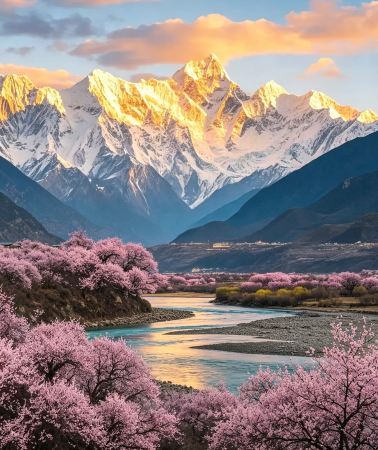
Namcha Barwa Peak is located in Nyingchi. Atop the mountains in the scenic spot are glaciers and thick misty clouds. The vegetation here grows thick and green, creating a beautiful natural environment. There are many places to take in the grandeur of Namcha Barwa Peak. From the Yarlung Tsangpo Grand Canyon Scenic Area Scenic Platform, visitors can take a sightseeing bus to the Yarlung Tsangpo Grand Canyon Scenic Area. The vista here is broad and open. From Sejila Mountain Pass, it is possible to see all the way to the rich scenery of Lunang Forest at the foot of the snowy mountains. Facing towards the snowy mountains, the traditional Susong Village can be seen. Every spring, the peach blossoms and snowy peaks as seen through the flowers make for an even more amazing sight.Mainling · 93.6km from downtown

Suosong Village
Located on the north bank of the Yarlung Zangbo River Grand Canyon in Nyingchi City's Milin County, Suosong Village is well off the beaten track. It is a good place from which to watch the sun set over the nearby Namcha Barwa Mountain. Compared with the lively Zhibai Village, Suosong is a very quiet village surrounded by idyllic scenery. The Yarlung Zangbo River is next to the village. There is also a lush peach forest. Every spring, the peach blossoms combine with the surrounding rivers and snowy mountains in the background to make a very beautiful and picturesque scene.Mainling · 76.8km from downtown

Yani National Wetland Park
Yani National Wetland Park is located in Nyingchi, with the river surface at an altitude of about 2,920 meters. It is a must-go place for Nyingchi to the Yarlung Zangbo Grand Canyon. The glass viewing platform in the park can overlook the confluence of the Niyang River and the Yarlung Zangbo River. There is a sign on the platform that says "You must drive 318 in this life". If you choose to take a boat tour, you can watch the different colors of the confluence of the two rivers up close, and you can also appreciate the scenery on both sides of the river. The south bank is the Himalayas, and the north bank is the sacred mountain of Benri.Mainling · 45.4km from downtown

River Confluence
River Confluence is located in Bayi District, Nyingchi, by the Yarlung Zangbo River, with the Gangpai Highway passing nearby. The Niyang River flows into the Yarlung Zangbo River here, where the clear river water meets the turbid river water, creating different colors on the surface and forming winding, intersecting lines. The river valley is wide, with sandbars and mudflats set against distant mountains. As the weather changes, cloud shadows drift across the mountains, and the river breeze brings a moist air. Standing at the viewing point, you can see the river waters slowly merging, with the boundary shifting with the current, appearing and disappearing. Travelers driving along the Gangpai Highway can park in safe areas to view the scenery from a distance and enjoy the sight of the waters embracing and the river surface stretching out. The light is soft in the early morning and evening, making the scenery richer in layers, but the plateau weather is changeable, so be prepared with windproof and warm clothing, and pay attention to rainfall and road conditions. When near the water, do not wade or climb on slippery rocks, and follow on-site instructions. This is also a great place to experience the landscapes and river culture of Nyingchi, and can be visited in combination with the surrounding villages and river valley scenery. Please respect local customs, do not litter, and protect this pure land and water.Mainling · 33.7km from downtown

Namjagbarwa Peak Viewing Platform
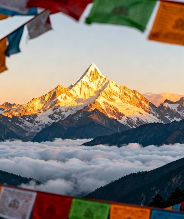
The Namjagbarwa Observation Deck is located in Milin County, Tibet, and is an ideal place to enjoy the magnificent view of Namjagbarwa. Namjagbarwa is known as the "Paradise in the Clouds". Its main peak is 7,782 meters above sea level and is one of the highest peaks in the eastern end of the Himalayas. The observation deck has a superior geographical location and a wide view, attracting photography enthusiasts and nature lovers all year round. The observation deck is surrounded by beautiful environment, rich vegetation and fresh air, making it an ideal place to relax. Early morning and evening are the recommended time to view Namjagbarwa, with the sun shining on the peak, presenting a magnificent golden scene. Visitors can experience the shock and tranquility of nature here. The transportation to the observation deck is convenient, and the scenery along the way is beautiful. Visitors can choose to drive or take local transportation. There are basic tourist service facilities near the observation deck, providing convenience for eating and resting. Whether it is a short stop or a long stop, the Namjagbarwa Observation Deck can bring visitors an unforgettable travel experience.Mainling · 80.4km from downtown

Daduka Ruins
Mainling · 75km from downtown

Yarlung Zangbo River
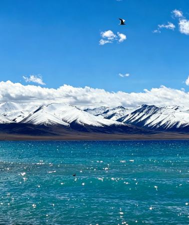
Yarlung Zangbo Riveris one of the representative natural landscapes on this plateau. The river originates from the snow-capped mountains of the plateau, traverses vast mountains and deep canyons, and forms a rich and diverse natural landscape within Nyingchi. Here, snow-capped mountains, forests, canyons, rivers, and meadows intertwine, showcasing a unique and magnificent ecological environment. High mountains stretch along both banks, with some peaks covered in snow and others covered with dense forests. The clear river water winds through the mountains. In some sections, the current is gentle and the river surface is wide, while in other areas, it flows through steep canyons, forming a magnificent landscape. Looking from a distance, the blue sky, white clouds, snow-capped mountains, and the turquoise river water complement each other, presenting distinct and layered plateau colors. In spring and summer, the valleys are lush and green, with wildflowers dotting the meadows. In fall, the forests are rich in color, forming a gorgeous natural painting together with the clear river water and the distant snow-capped mountains.Nyingchi · 29.8km from Mainling

Zangbu Badong Waterfall Group
The Zangbo Badong Waterfalls are actually two waterfalls. Located at the foot of Xixingla Mountain, about 20 kilometers away from the entrance of Pulong Zangbohui, the riverbed is 2140 meters above sea level; on the riverbed 600 meters apart, there are two waterfalls here, 35 meters high (Zangbu Badong Waterfall II) and 33 meters (Zangbo Badong Waterfall I), the former is only 35 meters wide, which is the larger riverbed waterfall in the Yarlung Zangbo Grand Canyon.Mainling · 96.7km from downtown

Basomtso
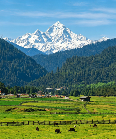
Pagsom Co is also known as Gongga Lake. It means "three rocks" in Tibetan. Located in Gongbo'gyamda County, it is a sacred lake of the Nyingma Branch of Tibetan Buddhism. The shape of Pagsom Co is like a crescent embedded in the deep valley. The water is clear, reflecting the surrounding snowy mountains and primordial forests. The Tsozong Gongba Monastery stands on Tashi Island and was built during the late Tang Dynasty. The reefs on the island are carved into images of animals and Buddha statues. Tsozong Gongba Monastery is a two-story structure of earth and wooden materials. The three statues, Chenresig, Guru Rimpoché and Sakya Thukpa, are worshiped here.Gongbo'gyamda · 92km from Mainling
Free things to do in Mainling
Yarlung Zangbo Grand Canyon
Mainling · 76.1km from downtownMount Namcha Barwa
Mainling · 93.6km from downtownSuosong Village
Mainling · 76.8km from downtownYani National Wetland Park
Mainling · 45.4km from downtownRiver Confluence
Mainling · 33.7km from downtownNamjagbarwa Peak Viewing Platform
Mainling · 80.4km from downtownDaduka Ruins
Mainling · 75km from downtownYarlung Zangbo River
Nyingchi · 29.8km from MainlingZangbu Badong Waterfall Group
Mainling · 96.7km from downtownBasomtso
Gongbo'gyamda · 92km from Mainling
More ways to travel from Mainling
Private Tours in Mainling
View More Private Tours in Mainling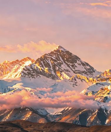


What travellers say about Mainling

wakin20005 October 2026
5.0
The Yarlung Tsangpo Grand Canyon Scenic Area is located in Nyingchi, Tibet. It is the world's largest canyon and the best place to view Namcha Barwa Peak. It forms a giant horseshoe shape around Namcha Barwa Peak, and its core attraction is the breathtaking view of snow-capped mountains and canyons side by side.
Yarlung Zangbo Grand Canyon

205***1516 October 2026
5.0
Namcha Barwa is absolutely worth a visit! I went with my family. Located in Nyingchi, Tibet, Namcha Barwa is shrouded in mist year-round. At 7,782 meters, it's the highest peak at the eastern end of the Himalayas. At its foot lies the Yarlung Tsangpo Grand Canyon—the world's deepest canyon. The weather was pretty good the day I went; although clouds obscured the summit, I could still see almost the entire mountain, so I was lucky. It was a bit of a shame that the sun wasn't strong enough to see the golden sunrise on the mountain.
Mount Namcha Barwa

懒大王爱睡觉觉7 September 2025
4.0
Suosong Village: A Peach Blossom Secret Hidden on the Banks of the Yarlung Zangbo River
If you're looking for a place that blends snow-capped mountains, a river, and peach blossoms into one stunning scene, Suosong Village should be high on your list.
It sits midway up the Yarlung Zangbo Grand Canyon, overlooking the majestic silhouette of Mount Namjagbarwa and the surging Yarlung Zangbo River. In spring, peach blossoms blanket the mountains, while in autumn, layers of forests paint the valley. Even the morning mist on ordinary days seems to shroud the village in a gentle veil.
Most of the village's inns have been converted from Tibetan-style dwellings, offering breathtaking views from the window. In the evening, sit in the courtyard and watch the sunset gild the snow-capped mountains. In the morning, listen to the gurgling river and wait for the first rays of sunlight to penetrate the clouds, and even time seems to slow down. There's no need to search for scenic spots; simply stroll along the village roads, encounter villagers carrying barley, or find a quiet spot on a rock by the river to experience the healing power of the Tibetan mountains.
The only thing to note is that you need to book a room in advance during the peak season, and it is recommended to drive slowly as the mountain road is winding - but the journey is definitely worth it.
Suosong Village

卡皮巴拉游世界5 June 2025
5.0
雅尼湿地,位于西藏林芝市,是雅鲁藏布江与尼洋河的交汇处,总面积达8738公顷。这里碧波荡漾,草木葱茏,拥有丰富的生物多样性,是众多候鸟的重要栖息地。从昔日的荒草滩到如今的水波荡漾、风光旖旎,雅尼湿地见证了生态修复的奇迹。漫步于此,您可尽享高原生态之美,感受自然与人文的和谐共生。
Yani National Wetland Park

格格巴24 March 2021
4.0
The confluence of rivers is a viewing platform in Milin County, where the Niyang River and the Yarlung Zangbo River meet. At the confluence, the water of the Niyang River is clear and turbid, while the water of the Yarlung Zangbo River is turbid and slow-flowing, with a clear distinction between the two. The water of the Niyang River flows upstream into the Yarlung Zangbo River, forming a spectacle of reverse flow.
River Confluence

CD云上30 June 2021
4.0
At the end of March, I went to Nyingchi to see peach blossoms and enjoyed the panoramic view of the "Namjagbarwa Peak", which is known as the shy peak that "nine out of ten people have never seen". This trip was really worth it. Especially when it was rainy on the day of arrival, the sky was clear the next morning. The beautiful Namjagbarwa Peak unveiled its mysterious veil and showed itself to us without reservation. I was very lucky to hear the guide say that it is harder to see in the morning than at night. Namjagbarwa means a spear piercing the sky in Tibetan. It is the easternmost end of the Himalayas. The huge triangular peak is covered with snow all year round and is very spectacular.
Namjagbarwa Peak Viewing Platform

IvanFC21 October 2020
5.0
Daduka Village is a must-go place on the Yarlung Zangbo Grand Canyon hiking route. On the bank of the Duka River, there are the remains of an ancient castle. It is said that it was once the manor castle of the Gongbu King. It was destroyed by artillery in the war and is now just a ruin.
Daduka Ruins

M29***5129 January 2026
5.0
The Yarlung Tsangpo River is China's longest plateau river and one of the world's highest-altitude major rivers, often referred to as the "Mother River of the Plateau." It originates from the Jiemayangzong Glacier on the northern slopes of the Himalayas, its name in Tibetan meaning "snowmelt flowing from the high mountains." This great river flows eastward from its source, sometimes wide and gentle, sometimes roaring and turbulent, nourishing the land and life of the Qinghai-Tibet Plateau.
The Yarlung Tsangpo River offers diverse landscapes along its course, showcasing the majestic grandeur of the Earth's "Third Pole" from its source glacier to its downstream canyons. South of Nyingchi, the river cuts through the Himalayas, forming the world-famous Yarlung Tsangpo Grand Canyon. This canyon stretches 504.6 kilometers from Daduoka Village in Milin City in the north to Baxika Village in Motuo County in the south, with an average depth of 2268 meters and a maximum depth of 6009 meters, making it undeniably the deepest and longest canyon in the world. The core area of the canyon forms a massive U-shaped bend around Namcha Barwa Peak, characterized by towering mountains, deep valleys, and swift-flowing water. The downstream section of the canyon has a significant drop in elevation and rapid currents, making it one of the world's richest and most concentrated areas of hydropower resources. The canyon region also boasts some of the world's most abundant rare biological resources. Currently, the nation has begun construction of the Yarlung Tsangpo Hydropower Station, a super-large hydropower station, here.
Yarlung Zangbo River

闲庭漫步3014 October 2026
5.0
The scenery was beautiful, the experience was fantastic, and the management was excellent; the entire trip was very comfortable. I hope the sightseeing bus service to Jiba Village can be improved to make it easier for tourists to get in and out.
Basomtso


