Dogtail is also my hometown beautiful scenery worth the outdoor enthusiasts to cross; at the same time, the Yi compatriots welcome you to visit.
;
Gouweizhang Review
5 /55 Reviews

5/5
Gouweizhang
Posted: Jan 11, 2016


3 person liked this
Like
 5/5OutstandingOriginal Text
1. Wild mountains, no development, no formal roads, are all mountain paths, the second half of the rugged road to climb the mountain. 2. Because there is no development, it is not a local, and the entrance to the mountain is difficult to find. I also navigated to the neighborhood and asked the local villagers before finding the mountain road. And it is easy to get lost on the mountain, pay more attention to the red ribbons left by the predecessors. 3. Don't travel with too many people or too few people, 3-6 is more suitable. 4. Be sure to bring good water, gloves, windbreaker, the weather on the mountain is changeable, be sure to leave enough time to go down the mountain, if you are still on the mountain, you will not find the mountain road. 5. Many good, if you like to climb the mountain, the real meaning to climb the mountain.
Posted: Jan 3, 20204 5/5OutstandingOriginal Text
It's Changshanzi Village, not Zhangshanzi, don't mislead people.
Posted: Oct 20, 20210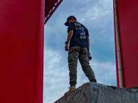 Original Text
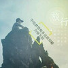
As the fourth peak in Guangdong, the name is naturally not as large as the highest altitude. There is no figure in the famous mountains of Guangdong. The name of the dog tail is quite grounded, even some soil, but it is quite distinctive.  Feature recommendation: The steepness of the peak is rare in Guangdong, and the cliffs are almost vertical. The long and narrow mountains directly block the monsoon, and the scenery on both sides of the peak is amazing. On one side, similar to the karst landform of Yangshuo, Guilin, hundreds of small hillsides are neatly arranged at the foot of the mountain, stretching for dozens of kilometers, looking like thousands of troops and horses. On the other side, the rolling mountains can't see the head at a glance. Yellow meadows cover the top of the mountain, and rock-breaking meadows of faults reveal tenacious will. From the top overlooking the ridge, yellow meadows are on one side and the hurried woods are perfectly divided by the ridge. From the bottom of the mountain to the top, you will pass through bamboo forests, streams, mountain springs, bushes, meadows, cliffs, cliffs, and steep ridges. The scenery changes and changes, and the colorful layers are lingering. At noon, the bright moon is hung on the blue sky, making this outdoor hike interesting.  Detailed address: Navigate Ruyuan Zhangshanzi Village. After getting off the highway, there will be a county road more than 10 kilometers away, and finally there is an open space in Zhangshanzi Village where you can park. The mountaineering entrance is behind the village committee.  Practical tips: Risk! Very dangerous! More than ten meters high cliffs on the way do not have any protection, no rope, need to climb with bare hands. New donkeys are not recommended to try. Teamwork is quite important, remember to hike alone. The reason is the same. Please prepare two trekking poles, believe me! This will be useful for you climbing steep sections. Don't overestimate your strength. If conditions permit, it is recommended to wear knee pads down the mountain. The probability of sour legs slipping on the downhill section is very high. Finally, there is a mountain closure warning. Interested friends, please consult the local government department in advance if you can go up the mountain. This mountain, don't try the new donkey, remember! Remember!
Posted: Feb 23, 20211 Original Text
Visiting around Guangzhou | What kind of experience is dog tail camping? Guangdong Niubei Mountain Yunhai casually look at it. It is highly recommended to navigate to the "Changshanzi". Guangzhou comes and rests at the service station for about 4 hours. There are parking spaces and canteens in front of the village hall. Can be used as the final supplement of the material before climbing, the villagers are extremely simple and enthusiastic, asking about the strategy and route is not the case. From the starting point of the village guide mark, you can climb the ridge for 1 hour to the ridge. The scenery is suddenly bright, and the mountains in the distance are heavy and stacked. It is a bit similar to Qingyuan Moliugong Mountain. The layers are clear. Walking along the ridge, enjoying the beautiful scenery and not feeling hard, but you need to pay attention to sun protection. No vegetation can only be completely exposed to ultraviolet light, just one afternoon can be sunburned outside tender, extra delicious. The time taken from the bottom of the mountain to the top of the mountain varies from person to person. The altitude of the foot of the mountain to the top of the mountain climbs to 1000. Generally, it only takes two to three hours for light installation. It takes one hour for heavy camping. The closer to the top of the mountain, the steeper the mountain road, and some sections need to be used by hands and feet to ensure safety. It is recommended to do a good weather strategy before going up the mountain. In case of rain, the mountain will be quite sad and dangerous. I started climbing alone at the foot of the mountain at 4:30 pm that day, and arrived at 8 pm at the ridge level 100m above the mountain (no night road and rich outdoor experience are not recommended to try). The camp is not big, there are gravel for rock ground, unconditionally nailed, so you need to find some large stones to put in to fix the tent. The view is wide, the sunrise and sunset, the beginning and the end of the moon are unobstructed, as long as you are not too tired, you will definitely not regret all the photography equipment you have, as long as the weather is clear and the moon is missing, the Milky Way is arranged in minutes, and the next day with the dawn, the tent door is opened at the foot of the sea of clouds. There is no trace of cover, and the visual impact is extremely strong. There is also a point that needs to be particularly clear. There is no water supply on the mountain. You need to carry enough water on the mountain to lightly pack it. Just carry the water back and forth on the day and some rations. Reloading needs to be backed with sufficient water, personal advice at least 3L, tents, moisture-proof mats, sleeping bags are not at all, the jacket is still necessary anyway, no matter what season, there is any chance of rain or strong wind at any time, low temperature is also inevitable. Be prepared for everything is the greatest respect for the mountain. Shaoguan·Dogtail parking is free, up the mountain is free
Posted: Oct 28, 20210
Popular Destinations
Valencia Travel | Kos Travel | Sharjah Travel | Gdansk Travel | Oslo Travel | Lake District Travel | Sharm El Sheikh Travel | Coventry Travel | Gothenburg Travel | Perth Travel | Newquay Travel | Malaysia Travel | Abuja Travel | Redang Island Travel | Norwich Travel | Koh Tao Travel | Lancaster District Travel | Sri Lanka Travel | Erbil Travel | Da Nang Travel | Armenia Travel | Colwyn Bay Travel | Bangor Travel | Mount Fuji Travel | Davao Region Travel | Yanwath and Eamont Bridge Travel | Shinjuku Ward Travel | Tamil Nadu Travel | Torremolinos Travel | Tauranga City Travel
Recommended Attractions at Popular Destinations
Bangkok attraction near me | Tokyo attraction near me | Manila attraction near me | Hong Kong attraction near me | Seoul attraction near me | Taipei attraction near me | Los Angeles attraction near me | New York attraction near me | Shanghai attraction near me | Kuala Lumpur attraction near me | Shenzhen attraction near me | Guangzhou attraction near me | Osaka attraction near me | Singapore attraction near me | London attraction near me | San Francisco attraction near me | Beijing attraction near me | Macau attraction near me | Bali attraction near me | Paris attraction near me | Orlando attraction near me | Jakarta attraction near me | Ho Chi Minh City attraction near me | Phuket attraction near me | Chicago attraction near me | Toronto attraction near me | Cebu attraction near me | Dallas attraction near me | Istanbul attraction near me | Dubai attraction near me
Popular Attractions
Stonehenge | Genting SkyWorlds Theme Park | Titanic Belfast | Andamanda Phuket Waterpark | London Eye | Keukenhof | Universal Studios Japan | The British Museum | Tokyo Disneyland | Sky Garden | Burj Khalifa | Blackpool Pleasure Beach | Zhengzhou Fantawild Adventure | SeaWorld Orlando | Eilean Donan | Dolmabahçe Palace | Sunset Stand Up Paddleboards | Skate N' Fun Zone | Mizu Day Spa | Nailin' Beauty | Santuario San Miguel in Excelsis | LaSource Spa - Massage and Facial | Walt Disney World Resort | The Thames Barrier | Warwick Castle | Sunway Lost World of Tambun | Library of Birmingham | Siam Park | Shanghai Tower | King Power Mahanakhon Sky Walk
Popular Travelogues
Bangkok Travelogue | Tokyo Travelogue | Hong Kong Travelogue | Seoul Travelogue | Los Angeles Travelogue | New York Travelogue | Shanghai Travelogue | Kuala Lumpur Travelogue | Shenzhen Travelogue | Guangzhou Travelogue | Osaka Travelogue | Singapore Travelogue | London Travelogue | San Francisco Travelogue | Beijing Travelogue | Macau Travelogue | Bali Travelogue | Paris Travelogue | Ho Chi Minh City Travelogue | Phuket Travelogue | Chicago Travelogue | Toronto Travelogue | Dubai Travelogue
Payment Methods
Our Partners
Copyright © 2024 Trip.com Travel Singapore Pte. Ltd. All rights reserved
Site Operator: Trip.com Travel Singapore Pte. Ltd.
Site Operator: Trip.com Travel Singapore Pte. Ltd.