OverviewBookNearbyReviewsWin PrizesRecommended
Share to
Pamirs Plateau
帕米爾高原6.7
764 Reviews
Open today at 08:30-20:30
Recommended sightseeing time:2-3 days
Address:
Pamir Mountains, ChinaMap
What travelers say:
The scenery of the Pamir Plateau is infinitely worth a visit! This road is snowy mountains, glaciers, grasslands, cattle and sheep, camels, deserts, and lakes under the blue sky and white clouds! And Xinjiang specialties are so fragrant! Great beauty Xinjiang! ! !
More
See all 55 photos
Saved by 29
Need to know
View More
Pamirs Plateau Highlights: Must-See Features and Attractions
Some information may have been translated by Google Translate
Pamirs Plateau is located in West China, extending across Tajikistan, China and Afghanistan. Consisting of East and West parts, Pamirs Plateau has a number of high mountains. East Pamirs is broad and level, formed by two mountain ranges oriented from northwest to southeast and a group of rivers, valleys, lakes and basins. West Pamirs is formed by multiple mountains and valleys running in parallel from northeast to southwest. West Pamirs is distinguished by its varied terrain, with high mountains and deep valleys.
Recommendations Near Pamirs Plateau
Pamirs Plateau Reviews: Insider Insights and Visitor Experiences
Some reviews may have been translated by Google TranslateWrite a Review
/5
Outstanding ReviewsAll (764)
Latest
With Photos (575)
Verified Booking (23)
Positive Reviews (325)
Negative Reviews (3)
- 1
- 2
- 3
- 4
- 100
Pamirs Plateau Photos: Trip Moments
 Touring Southern Xinjiang | Heading to the Pamir Plateau | Pamir always needs to be seen onceSome places, just hearing the name makes people love it, and Pamir is one of them. This land carries the snow-capped Muztagh, Gongger Jiubie Peak; it has Karakul Lake, White Sand Lake; there are Wakhan Corridor, Hongqirafu Port, and all these are centered on Tashkurgan, this border county town at the junction of three countries in western China. In terms of scenery, honestly, I think it may be slightly inferior to the Tibetan plateau landscape, but in a geographical sense, this is a place that must be visited once in a lifetime. And the Taerman Wetland is the place I think can best showcase the scenery of Pamir. Here, the blue sky, white clouds, snow-capped mountains, rivers and grasslands are perfectly integrated, presenting the most authentic plateau landscape. It is hard to find another picture that can simultaneously display snow-capped glaciers, red ridges, green pastures and gurgling streams. Each layer is a unique landscape and landform, but together they elevate this stunning scenery again. Southern Xinjiang is mostly desert, with a dry climate, and the Pamir Plateau is the same, but the Taerman Wetland is a rare plateau pasture. Muztagh Peak, known as the father of glaciers, has very developed glaciers. The huge ice tongues scatter down from the mountain, and the distant snow-capped mountains are Gongger Peak and Gongger Jiubie Peak, which are also the highest peaks on the west side of the Kunlun Mountains. "Today I have walked all the detours, and from now on my life is smooth", this sentence is absolutely a textbook-level tourism slogan. Whether my future is smooth, I don't know, but in Pamir, I have indeed walked a lot of detours these days. There are many other places worth checking in, such as the Apricot Flower Village in Datong Township, the signboard of the Wakhan Corridor, the Bandir Blue Lake on the Panlong Back Tower County Road, etc. But I think all the attractions are more meaningful because they are all part of the Pamir Plateau. Pamir is always worth exploring.ScarlettMcAllister95155
 If you haven't been to Southern Xinjiang, you won't know the beauty of Xinjiang - the Pamir PlateauThe mysterious Pamir. If you haven't been to Xinjiang, you won't know the vastness of China; if you haven't been to Southern Xinjiang, you won't know the beauty of Xinjiang. Southern Xinjiang is not only a place to see culture, but also scenery. Southern Xinjiang has the White Sand Lake, which is half white sand and half lake, the majestic Gongger Peak and Jiubie Peak, the Muztagh Peak known as the 'Father of Ice Mountains', the rugged Panlong Ancient Road, the Bandir Blue Lake, the Yarkand River, and the exotic Kashgar Old City. The snow mountains of the Pamir Plateau are so close that they seem to be within reach, and the emerald-like lakes change with the weather and angle at any time, everything is so beautiful that it makes people intoxicated ☺️ This winter, come to Southern Xinjiang for a visit.bittererbrianna31
 Xinjiang Muztag Peak | It is finally arrived at the Pamirs is finally arrived in the Pamirs, the westernmost border of the Chinese border, is also the southernmost coordinates of this Xinjiang road trip. The car is driving in the borderland, walking in the thin air of the Pamirs, sleeping night under the Muztag Peak, suddenly feels that those who have been quiet for thousands of years, it seems that they have never been clean The land has happened. Only plateaus, snow mountains, lake glaciers, into eternity. TipsLittle_Round_Circle.5
 The Pamir Plateau, the only plateau in XinjiangThe Pamir Plateau, in Persian, means 'the roof of the world'. In ancient China, it was known as the Congling, and the ancient Silk Road passed through it. It is located in the southeastern part of Central Asia, at the westernmost point of China, spanning Tajikistan, China, and Afghanistan. The Pamir Plateau stretches across the southwestern part of Xinjiang in China, the southeastern part of Tajikistan, and the northeastern part of Afghanistan, and is a massive mountain junction where the Kunlun Mountains, the Karakoram Mountains, the Hindu Kush, and the Tianshan Mountains meet. It covers an area of about 100,000 square kilometers. The Pamir Plateau has towering mountains with an average altitude of over 4,500 meters, and its main peaks are all above 6,000 meters. The highest peak in the western part within Tajikistan is the Communism Peak at 7,495 meters, followed by Lenin Peak at 7,134 meters. There is a significant difference between the eastern and western parts. The western Pamir has both high absolute and relative heights; the latitudinal and longitudinal mountain ranges crisscross each other, creating a complex terrain with the characteristics of a high mountain plateau; the river network is dense, with deep cuts, and the planation surfaces are severely damaged. The eastern Pamir Plateau has a lower absolute height and relative height, with significant plateau features and broad valleys. The plateau is widely covered with glaciers, totaling 1,085, covering an area of 8,041 square kilometers. The longest Fedchenko Glacier is 77 kilometers long. There are numerous glacial lakes, with the largest being Lake Karakul, covering an area of 383 square kilometers and reaching a depth of 236 meters.JOHANNA JOSEPH
 Crying all the way out from Taxkorgan~ How could the Pamirs be like thisThe Eye of the Pamir Plateau, the Muztagh Ata volcanic crater Above the Pamir Plateau, the beautiful scenery along the way from Taxkorgan can really make one cry from its beauty. Especially the grassland at the foot of the snow-capped mountains, golden yellow, always makes one feel that the white snow and yellow grass are a pair of beauties, steadfastly guarding the Pamir Plateau year-round, enduring the wind and sun, while they only care about the clear distinction of the four seasons cycling through their beauty. --- I don't know how you feel, but when real life truly enters the geography textbooks, my feeling is that I want to cry. Standing on the edge of the Muztagh Ata volcanic crater, looking at the endless snow-capped mountains around, you will be filled with an inexplicable emotion by the nature in front of you. That vastness, that biting cold wind, those endless snow-capped mountains, seem to be telling you that all beings are like grass and trees, all beings are equal, everything in nature will have its encounters and fate. Just like starting from a book, I became someone who came here from thousands of kilometers away. --- The largest wetland grassland on the Pamir Plateau is wrapped in snow-capped mountains, the grass is yellow to the point of being red, looking down from the sky, it looks just like a red heart duck egg, this place is the imagination space and world for foodies. --- It's a bit of a pity that the drone can only fly 500 meters, not high enough to capture the most handsome profile of the Pamirs. But I have to say, after experiencing several near-crashes before, this time was the most stable flight, look, I even got myself in the shot. --- The Muztagh Ata volcanic crater, it seems that in a year's time, it will also be directly turned into a tourist attraction, which makes me feel a bit regretful. Because once it's fenced off, its shape will have a definition that shouldn't belong to it, and it will lose its original unique charm. But my Pamir - the Muztagh Ata volcanic crater pact, was perfect. .....RACHEL FREEMAN
 I regret going to Xinjiang, the aftereffect is even more intense than a heartbreakAt this very moment🌿, I have already started to look forward to the enchanting summer of Xinjiang🌞🏞️. Every year at this time, I can't help but eagerly anticipate the summer days in Xinjiang🔥💭. The summer in Xinjiang is breathtakingly beautiful!! The summer in Xinjiang is breathtakingly beautiful!! In Xinjiang, you can find the ultimate colors of nature🌈🎨: The azure of Sayram Lake, the emerald green of Ili, the light purple of Huocheng, The fiery red of Aoyi Takte, the sandy yellow of the ancient city of Kashgar, the pure white of White Sand Lake. Xinjiang is vast, divided into southern and northern parts by the Tianshan Mountains: ⛰️Southern Xinjiang is a magnificent combination of culture and nature, explore the 'One Thousand and One Nights' stories of the ancient city of Kashgar, gaze at the glaciers under Muztagh Ata, experience the White Sand Lake and the ancient Panlong Road on the Pamir Plateau, overturning your perception of Xinjiang. 🍃Northern Xinjiang is the stunning scenery of grasslands and mountains, whether it's Nalati, Qiongkushitai, Qiaxi or Kalajun, these grassland beauties of Ili are all worth visiting. 🚌Xinjiang travel route suggestions: ✅Northern Xinjiang: Urumqi ➡️ Sayram Lake ➡️ Guozigou ➡️ Huocheng ➡️ Xiate ➡️ Tekes Bagua City ➡️ Qiongkushitai ➡️ Nalati ➡️ Duku Highway ➡️ Urumqi ✅Southern Xinjiang: Kashgar ➡️ Aoyi Takte Red Canyon ➡️ White Sand Lake ➡️ Karakul Lake ➡️ Taxkorgan ➡️ Tashkurgan Wetland ➡️ Panlong Ancient Road ➡️ Tasha Ancient Road (Xia Ban Di Reservoir) ➡️ Yarkant ➡️ Kashgar 🚗Xinjiang travel transportation suggestions: The vastness of Xinjiang is breathtaking! There are airports everywhere, with direct flights for convenience. The best way to travel is by renting a car for a road trip, if you can't drive, consider finding a reliable chartered car service. I have driven myself in both southern and northern Xinjiang for 10+ days each, and the experience was extraordinary. ☀️Essential knowledge for traveling in Xinjiang: 1️⃣Xinjiang's climate is dry, especially in the south, do not neglect moisturizing. 2️⃣The ultraviolet rays are strong, be sure to bring sunscreen, sunglasses, and a hat when going out. 3️⃣The distance between southern and northern Xinjiang is quite far, plan your itinerary and time reasonably. 4️⃣July and August are the peak tourist seasons, book hotels in advance, especially in popular areas like Qiongkushitai.GlobalWanderer3
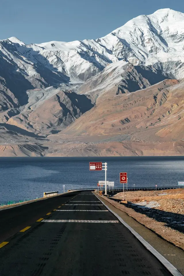 Pamir Plateau Travel Guide!!!Itinerary DAY1⃣️ 📍Kashgar (depart at 10:00) 📍Oytag Glacier Park (arrive at 12:40, depart at 13:50) 🗻Altitude: 2804 🎫: 45 + shuttle bus 6 yuan 📝: On the way, you will see beautiful snow-capped mountains surrounding you. After arriving at the scenic area, take a shuttle bus to the foot of the mountain. To climb further, you need to walk another 1-2km. (If you plan to visit Kanas later, you can skip this part) 📍White Sand Lake (arrive at 16:02, depart at 16:40) Half vast white sands and half clear blue waters, it's like a fairyland. 🗻Altitude: 3300 🎫30/person, yak🎫: 30/person There are free attractions to see, and you can also ride a yak along the lake for a scenic journey. 📝: There are many small flies on the yaks, but don't worry, they don't bite and will follow you after the ride 📍Karakul Lake (arrive at 17:43, depart at 18:20) 🗻Altitude: 3600 🎫45/person 📝: There are beautiful plank roads, and you can see the Mustagh Ata peak, which is very stunning, but due to the high altitude, it is not recommended to ride horses 📍Mustagh Ata Peak (arrive at 18:50) 🗻Altitude: 4000+ 🎫40/person, shuttle bus 50/person, 20 minutes by car, then a walk of about 1 kilometer. 📝: The park closes at 18:00, we arrived late and only took photos from outside. Self-driving friends should set off earlier 🥹At this time, I was seriously suffering from altitude sickness in the car, and the photos were taken by a friend 📍🏠: Checked into Taxkorgan at 19:47 The sunset is super beautiful, and you can enjoy a steaming hot pot. It's quite cold at night, it's recommended to wear long-sleeve pajamas and pants, and wear a fleece-lined jacket when going out DAY2⃣️ 📍Depart from Taxkorgan at 10:00 📍Pass by the Wakhan Corridor 📍Panlong Ancient Path 11:00-13:10 (we might have run a bit fast) 🗻Altitude: 3000-4300 📝: Have breakfast before setting off. Prepare motion sickness medicine, altitude sickness medicine, and oxygen bottles, as there are over 600 turns on the way🥹 📍Bandier Blue Lake (Xia Ban Di Reservoir) Arrive at 13:50, return at 15:00 🗻Altitude: around 3000 The weather is super nice and the scenery is super beautiful! There is a path below, you can walk to the lakeside 🚗: Return trip Return to Kashgar via the G314 national highway, passing by Mustagh Ata Peak and White Sand Lake. 📝Tips: ①High altitude can cause altitude sickness, so keep your movements small and prepare oxygen tanks before setting off, as they are quite expensive in the scenic areas ②Bring a sports watch/pulse oximeter to monitor your condition in real-time and go to the hospital if you feel very unwell! ③Prepare food, as when traveling in Xinjiang, you're usually on the road ④Bring warm clothes, as the temperature can drop to as low as 6℃ at nightGabriel.Jenkins.95
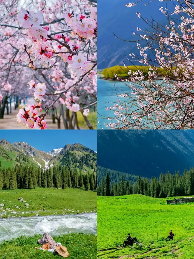
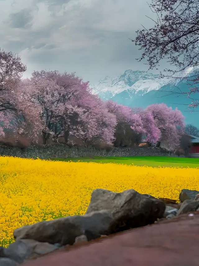 Where to go in April, highly recommendedApril is the best time to travel!!! April in spring, a good season! It's the perfect time to see the flowers! Here, I recommend a few places of poetry and distance for everyone. At the end of March and the beginning of April every year, this place will be the most beautiful. 1️⃣ The first place: Peach blossoms in Linzhi, Tibet, known as the 'Little Jiangnan' of Tibet, is really healing! Every year from the end of March to the beginning of April, from 3.15 to 4.15, the Linzhi area is a peach blossom paradise. Snow-capped mountains, peach trees, and barley fields, the villages are like a secret realm, where one could stay for a whole day. 2️⃣ The second place: Apricot blossom villages such as the ancient Tashkurgan Trail and Datong Township in the Pamir Plateau region of Xinjiang. The exotic charm here hides quaint villages, and the mountains and rivers here are full of life in this spring. The ancient apricot trees, with the end of March being the best time to view the blossoms. 3️⃣ Xinjiang Yili Turgen Apricot Blossom Valley, where apricot trees cover the mountains and valleys. The spring here is the most beautiful, in early April, around Qingming, a brief week, interpreting the fairy tale of spring. 🔥 The above three places are the must-visit checkpoints for the spring travel ceiling. If you also long for the spring here, then let's go together!gwendolyn_juniperhale
 Under the Lens: Spring and Scenic Clarity | March Xinjiang Apricot Blossom Viewing GuideMarch Xinjiang Apricot Blossom Viewing Guide. I dare say, Xinjiang in March and April is the pinnacle of spring beauty in China Every year in March and April, the apricot blossoms in Xinjiang quietly bloom From the Pamir Plateau to the Yili Apricot Blossom Valley, the journey is like a fairy tale Wild apricot blossoms flourish in the canyons In the villages, there are apricot trees that are over a hundred years old Contented cattle and sheep... A casual snapshot is a beautiful landscape painting . 🌸The Best Time to View Apricot Blossoms Late March to early April (the blooming period varies by location, so be sure to check the status of the blossoms in advance to avoid missing them) . 🌝🌝Apricot Blossom Viewing Spots 1. Pamir Plateau Apricot Blossom Valley Mainly around Datong Township and Tashkurgan Township On the road to chasing apricot blossoms, the journey is filled with scenery, and it is recommended to enjoy the Pamir Plateau's landscapes along the way: Mustagh Ata, White Sand Lake, the famous 'Dragon Road' and so on The scenery along the way is stunning Additionally, you can experience Tajik folk customs …… 2. Yili: Apricot Blossom Valley (blooming period is in mid to late April) The blooming period is slightly later than the Pamir Plateau Last year I went a few days early, and only one tree had blossomed It's a good idea to pay attention to real-time information about the scenic area, to visit during the optimal viewing period . When the flowers bloom in the warmth of spring, go to Xinjiang! The spring scenery under the lens is right there .TravelerTales1
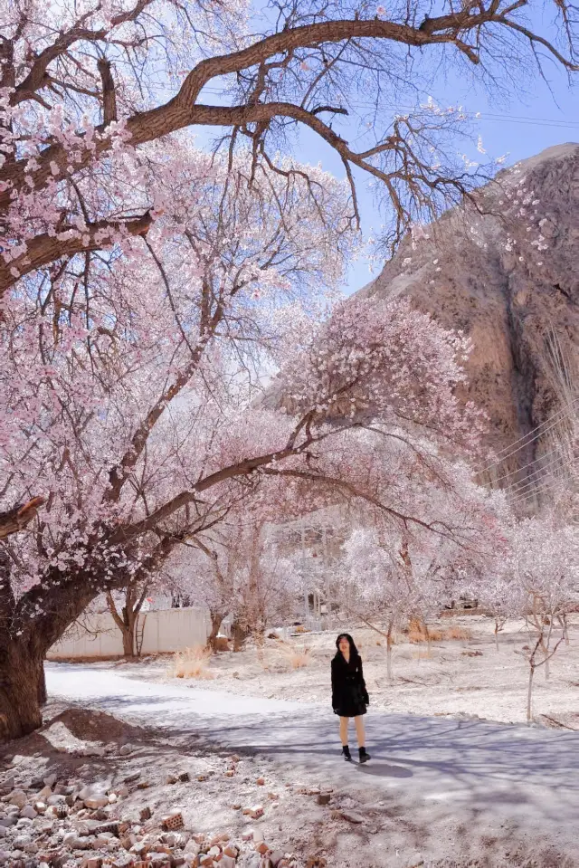
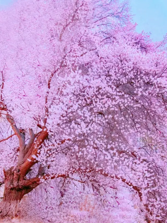 The romance of Southern Xinjiang begins with the apricot blossoms of the Pamir PlateauIt must be the earliest spring in China, a place recommended by 'National Geographic'! This is the Apricot Blossom Village on the Pamir Plateau of Southern Xinjiang. Come spring, century-old apricot trees cover the sky and the sun, mountains and rivers accompany each other, competing to bloom along the perilous Tashkurgan Trail, surrounding the Tajik villages, at the end of March each year, this narrow valley turns into a pink dreamland. The Tajik villages are hidden among them, where earthy yellow and pink interweave, echoing the beauty of the Peach Blossom Spring described by Tao Yuanming. Flower viewing season: Around March 20th to April 10th every year, lasting about half a month Flower viewing route: Kukexiluke Township - Tashkurgan Tajik Autonomous Township - Datong Township Kukexiluke Township: Here, the apricot blossoms bloom between snow-capped mountains and canyons, with a relatively later blooming period than other villages. The primitive earth houses and fields are all blooming with apricot blossoms, definitely a secret garden of apricot flowers Tashkurgan Township: Famous for the Apricot Blossom Avenue, Happiness No.5 Bridge is located here, where old apricot trees bloom densely and grandly, utterly romantic, sure to feast your eyes. Datong Township: Known as 'Peach Blossom Spring - Apricot Blossom Village', every household's yard is filled with century-old apricot trees. Of course, besides apricot blossoms, along the way, we can also see many unique landscapes of the Pamir Plateau, such as White Sand Lake, Red Mountain Valley, Muztagh Ata, Panlong Ancient Trail, Bandier Blue Lake, etc., I have shared the itinerary and accommodation points as follows: 4-day itinerary recommendation: D1: Kashgar - Red Mountain Valley - White Sand Lake - Mujie Volcano Crater - Karakul Lake - Taxkorgan (stay in Taxkorgan) D2: Taxkorgan - Start of the Wakhan Corridor - Panlong Ancient Trail - Bandier Blue Lake - Kukexiluke - (stay in Apricot Blossom Village) D3: Kukexiluke Township - Tashkurgan Tajik Autonomous Township - Datong Township - Taxkorgan (stay in Taxkorgan) D4: Taxkorgan - Tashkurgan Wetland - Muztagh Ata - Karakul Lake - Kashgar (stay in Kashgar) The above itinerary can be adjusted on a small scale. Travel equipment list: Be sure to apply for a border pass first, there are places near the Kashgar Old City. Travel equipment: windbreaker, coat, down jacket, casual shoes, sun protection equipment: sunglasses, sun protection clothing, sun hat Electronic devices: mobile phone, power bank, selfie stick, tripod, camera Medicine: motion sickness medicine, high altitude sickness medicine, cold medicine, essential medicine for special groups Documents: ID card, driver's licenseNomadicEssence
 2024, 20-day grand tour of North Xinjiang【Opening】: Without visiting Xinjiang, one cannot comprehend the vastness of the country. 🛬【Itinerary】: D1 Urumqi airport pick-up D2 Urumqi - Heavenly Lake D3 Urumqi - Dushanzi Grand Canyon - Jinghe D4 Jinghe - Sayram Lake and Lavender - Kazanqi D5 Yining - Zhaosu - Xiatang - Tekes D6 Tekes - Kalajun - Qiongkushitai D7 Gongliu - Kuerdening - Tangbula D8 Tangbula - Narat D9 Narat - Huanai Nesdaiban - Bayinbuluk D10 Bayinbuluk - Duku Highway - Kuitun D11 Kuitun - Devil's City - Burqin D12 Burqin - Hemu D13 Full day free activity in Hemu D14 Hemu - Kanas D15 Kanas - Guanyu Pavilion - Wucailiu D16 Burqin - No.3 Mine Pit - Keketuohai D17 Keketuohai - Urumqi D18 Urumqi - Shanshan - Turpan D19 Turpan - Flaming Mountains - Karez Wells - Grape Valley D20 Urumqi airport drop-offCHEYENNE BALL
 A glimpse of eternity! In March, in southern Xinjiang, I encountered a shower of apricot blossoms on the plateauEvery year from mid-March to early April is the season when apricot blossoms bloom on the Pamir Plateau in southern Xinjiang. 👉Unlike the apricot blossoms in northern Xinjiang, those in southern Xinjiang bloom earlier.㊙️ Southern Xinjiang features ancient wild apricot blossoms intertwined with villages, offering a richer cultural atmosphere. 【Best Time to View Apricot Blossoms】 Mid-March to early April, with different blooming times due to varying altitudes. 【Attraction Introduction】 Pamir Plateau: Uncover the ethnic groups on the Pamir Plateau, step into the sea of flowers, stroll through the apricot forests, wander around homestays, and capture the beautiful scenery. Kashgar Old Town: With a long history, diverse culture, and strong ethnic characteristics, it is also the sub-venue for this year's Spring Festival. Tashkurgan Ancient Path: Hidden within the ancient path are not only apricot blossom villages but also bizarre rocks and magical landscapes. White Sand Lake: A sand mountain wrapped in silver sand naturally formed on the Pamir Plateau, where you can take breathtakingly beautiful pictures without any filters. Muztagh Ata Volcanic Crater: There are several scattered dormant volcanic craters of various sizes, which are very spectacular. Band-e Amir Lake: A hidden super sapphire on the Pamir Plateau, a less-known attraction. Happiness No. 5 Bridge: The rustic Happiness No. 5 Bridge connects the two banks of the Yeh River and brings together a thousand years of Tajik culture. 【Route Reference】 Day1: Kashgar Day2: Kashgar--White Sand Lake, Karakul Lake 'Muztagh Ata'--Taxkorgan Day3: Taxkorgan--Wakhan Corridor 'Panlong Ancient Path', Band-e Amir Blue Lake--Koksu/Tashkurgan Day4: Koksu/Tashkurgan--Tashkurgan Apricot Blossom Village, Western Region Tajik Villages, Herdsmen--Taxkorgan Day5: Taxkorgan--Pamir Plateau, Golden Grassland, Stone City--Kashgar Day6: Kashgar 【Travel Outfit Tips】 🔹In March and April, the temperature on the Pamir Plateau can vary greatly between day and night, so remember to bring several warm clothes. 🔹The plateau's ultraviolet rays are strong, and it's quite dry, so bring enough skincare products and hydrating masks. 🔹For apricot blossom photography, you can try light-colored dresses or Hanfu, while the old town is more suitable for brightly colored ethnic styles. 🔹Prepare some bright-colored hats & scarves as accessories, they make for great photos. 【Travel Tips】 1. There are many old apricot trees in Tashkurgan, and the shapes of the trees are very beautiful. 2. It's not easy to dispose of garbage in the apricot blossom villages, so please try to take the trash back to the county for disposal. Most of the older generation in the apricot blossom villages do not speak Mandarin. If you want to take their pictures, please gesture to ask first, and after taking the photos, you can show them. They are usually very willing. 3. Inside Happiness No. 5 Bridge, there is a grove of century-old apricot trees. The light is very good and beautiful in the morning, and when the wind blows, you can see a spectacular shower of blossoms. 4. If you don't plan to take the Shache Ancient Path, then there's no need to go to Datong Township; Kuzhu is enough.Aiden.Peterson^29
- 1
- 2
- 3
Nearby Attractions
Pamir Tourist Area | The Ancient Stone Town of Kashgar | Alar National Wetland Park | Tashiku'erganzhen | Viewing Platform of Taherman Wetland Park | 慕士塔格風景區 | 下阪地水庫 | 坎爾洋村 | 班迪爾藍湖 | Tashenku'ergan Tajike Zizhixian Museum | 塔吉克民俗村 | Tashenku Erganxian Museum | Taheman Township | Tizinapu Village | Baigawule Village | 塔什庫爾幹縣老年活動中心 | 葱嶺湖旅遊景區 | Qietimo De'eri | Tashkurgan Library | Tashkurgan Teenagers Activity Center | Pu Luxin Gun'eri | Puta Wuya'er | Eduri Ji'eri | 馬如卡爾 | 塔合曼濕地 | 向日葵園 | 8號星球 | 阿拉爾金草灘民俗園
Popular Types of Attractions in Tashikuergan
Popular Restaurants in Tashikuergan
Xunyangpinwei Restaurant | 冰山来客塔吉克美食餐厅 | 雪上酒店(塔什库尔干红其拉甫路店)·餐厅 | Chongqingquanjiafuchuan Restaurant | 干314国道农家乐 | 牛魔王牦牛滋补馆 | 中巴友谊咖啡厅 | 雷记高原牦牛骨汤锅馆 | Xiyuniuwangtongguomaoniu | 库米扬文化民宿·塔吉克妈妈味道美食 | 雷记高原牦牛骨汤锅馆 | 山花快餐 | 游云聚美食府 | 盘龙古道快餐厅 | 塔漂咖啡馆 | 优品味椒麻鸡 | 花儿为什么这样红音乐餐厅 | 火炬快餐厅 | 帕米尔家乡美味餐馆 | 碟滋味串串香火锅(塔什库尔干路店) | 蜀香老菜馆 | 蜀滋味 | 丝路帕米尔餐厅 | 谦详益粥铺 | 迪亚热木快餐 | 老传统椒麻鸡 | 高原鱼庄石锅鱼 | 帕米尔高原鱼庄 | 罕萨厨房(罕萨厨房(幸福小区对面)) | 川味特色小厨
Recommended Attractions at Popular Destinations
Bangkok attraction near me | Tokyo attraction near me | Manila attraction near me | Hong Kong attraction near me | Seoul attraction near me | Taipei attraction near me | Los Angeles attraction near me | New York attraction near me | Shanghai attraction near me | Kuala Lumpur attraction near me | Shenzhen attraction near me | Osaka attraction near me | Singapore attraction near me | Guangzhou attraction near me | London attraction near me | San Francisco attraction near me | Beijing attraction near me | Macau attraction near me | Bali attraction near me | Paris attraction near me | Ho Chi Minh City attraction near me | Orlando attraction near me | Jakarta attraction near me | Phuket attraction near me | Chicago attraction near me | Toronto attraction near me | Istanbul attraction near me | Cebu attraction near me | Dallas attraction near me | Seattle attraction near me
Popular Trip Moments
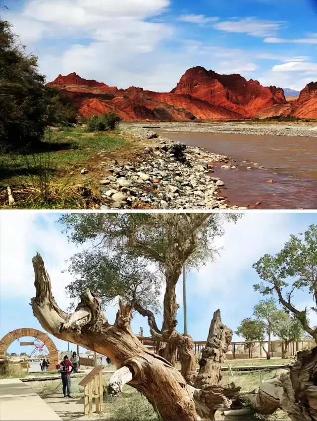
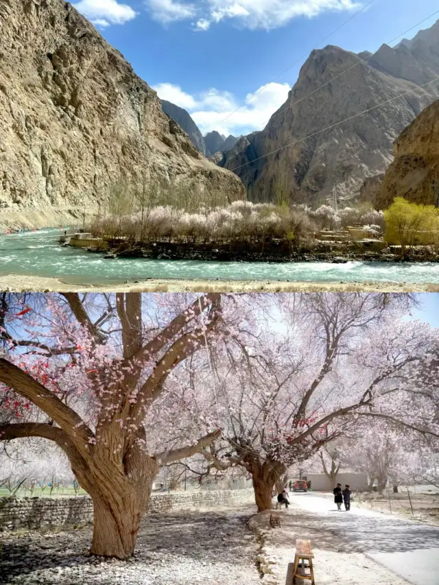
Xinjiang | Discover the secrets of the Aoyi Takte Red Valley in Southern Xinjiang's Pamir Plateau | In late autumn in southern Xinjiang, I took a trip there and captured 18 precious photos! | The 'Stone City' on the Pamir Plateau in Southern Xinjiang, part eight | The Pamir Plateau, the only plateau in Xinjiang | Pamir Plateau Apricot Blossom Secret Realm in Southern Xinjiang - Flower Viewing Guide | Crying all the way out from Taxkorgan~ How could the Pamirs be like this | Having taken all the detours in this life, from now on my path shall be straightforward | In this life, you must drive on the Panlong Ancient Road | From now on, life is all smooth | I regret going to Xinjiang, the aftereffect is even more intense than a heartbreak | In March, the apricot blossoms are silent, yet they convey the endless romance of Southern Xinjiang | 16 Days 15 Nights Grand Tour of North and South Xinjiang | Pamir Plateau Travel Guide!!! | Where to go in April, highly recommended | Panlong Ancient Road||The world's ultimate must-drive experience! | Under the Lens: Spring and Scenic Clarity | March Xinjiang Apricot Blossom Viewing Guide | The romance of Southern Xinjiang begins with the apricot blossoms of the Pamir Plateau | 2024, 20-day grand tour of North Xinjiang | The best viewing period for apricot blossoms in Pamir, Southern Xinjiang, is here - miss it and wait a year | A glimpse of eternity! In March, in southern Xinjiang, I encountered a shower of apricot blossoms on the plateau | 18 photos, are my longing for Xinjiang | Ili + South Xinjiang Essence 16-day Tour Guide | Pamir Tourist Area | The Stone City that witnessed the rise and fall of the ancient Silk Road, desolate and mysterious | Sharing the travel guide of the Panlong Ancient Road | Pamir Plateau | It's exploration and also a way home | Southern Xinjiang: Lake Karakul under the Mustagata Peak | The land route between China and Afghanistan, the mysterious Wakhan Corridor | Unveiling the Pamir Plateau: A breathtaking journey with magnificent sights! | A place where the temperature drops in a second, the Mustag Glacier Park | Mustagh Ata | Panlong Ancient Road 🪭
Popular Travel Types
More Things To Do in Tashikuergan
Trip to Fairy Meadows and Hunza Valley (7 days) | 6-Day Urumqi to Kashgar Private Tour: Heavenly Lake, Kashgar Old Town, Pamirs Plateau | 8-Day Urumqi,Turpan,Kashgar Private Tour include Heavenly Lake, Flaming Mountain | 4-Day Kashgar Private Tour to Karakul Lake, Id Kah Mosque, Abakh Hoja Tomb | 7-Day Urumqi,Turpan,Kashgar Private Tour include Kumtag Desert, Ancient city of Jiaohe | 12-Day South Xinjiang Private Tour included the Taklimakan Desert, Wensu Grand Canyon | China eSIM Day Pass/data Package days selected without cards QR code | China Mainland/Hong Kong/Macau eSIM (QR Code) | China Mainland eSIM|China Mobile Unlimited 4G High Speed Data | China, Hong Kong, and Macau eSIM|Total 5GB/10GB/15GB/20GB High-speed 4G LTE Unlimited high-speed data | Mainland China eSIM |China Mobile 4G high-speed unlimited data eSIM | Asia・Australia eSIM|AIS SIM2Fly 8 days 6GB High-speed Unlimited 5G/4G Data | [China Mainland] eSIM | SIM to China | 8GB 8days 4G high speed | Mainland China + Hong Kong + Macau eSIM 4G Data Daily Plan QR Code | Trip.SIM Japan, South Korea, Macau, Taiwan and many places in Asia + Australia and New Zealand 4G travel data roaming phone network card 4 days/7 days | Mainland China eSIM high-speed network QR code | China, Macau eSIM - Data plan by Gohub (QR Code) | Asia 9 Regions eSIM 4G Data Daily Plan QR Code | China, Hong Kong, Macau eSim 1/3/7/15/30 days (sent via email) by Xplori | China/Hong Kong/Macau eSIM 4G high-speed network QR code | eSender- Brunei/Indonesia/Singapore/Japan and many other countries and regions eSIM daily package/data package (QR code) | Mainland China + Hong Kong + Macau eSIM Data Plan QR Code | Asia 9 Destinations eSIM 4G Data Plan QR Code | China 4G SIM Card (HK, Macau, Taiwan, China Delivery Only) | AIS Asia esim data package (QR code) | [Hong Kong, Mainland China] 4G Internet Card | China Unicom/Hutchison | Unlimited data SIM card | Optional days | Insert the card and use | Self-pickup at Hong Kong Airport | Global (30 Countries) eSIM Data Package (QR Code) | Global eSim for 140+ countries (sent via email) by Xplori | [Mainland China] 4G Internet Card|China Unicom|Unlimited Data SIM Card|Number of Optional Days|Insert the card and use it|Self-pickup at Hong Kong Airport | Global multi-region A series eSIM|High-speed data, travel and business Internet access, optional unlimited data, optional days, QR code
Payment Methods
Our Partners
Copyright © 2024 Trip.com Travel Singapore Pte. Ltd. All rights reserved
Site Operator: Trip.com Travel Singapore Pte. Ltd.
Site Operator: Trip.com Travel Singapore Pte. Ltd.
The scenery of the Pamir Plateau is infinitely worth a visit! This road is snowy mountains, glaciers, grasslands, cattle and sheep, camels, deserts, and lakes under the blue sky and white clouds! And Xinjiang specialties are so fragrant! Great beauty Xinjiang! ! !
The ticket office can ask a tour guide. First, the sand plate in the ticket office will explain the entire terrain and surrounding attractions to you. After entering the stone city, you will be explained to you. However, I feel that the content of the explanation is not too much. If you join a group, you can also. If three or two, it doesn't feel necessary.
There are oxygen cylinders sold at the ticket office of the scenic spot, and there is no need to buy them at all. Most people have no reaction at this height, and the oxygen cylinders they sell are so expensive. There is yak beef hot pot opposite the price is very high.
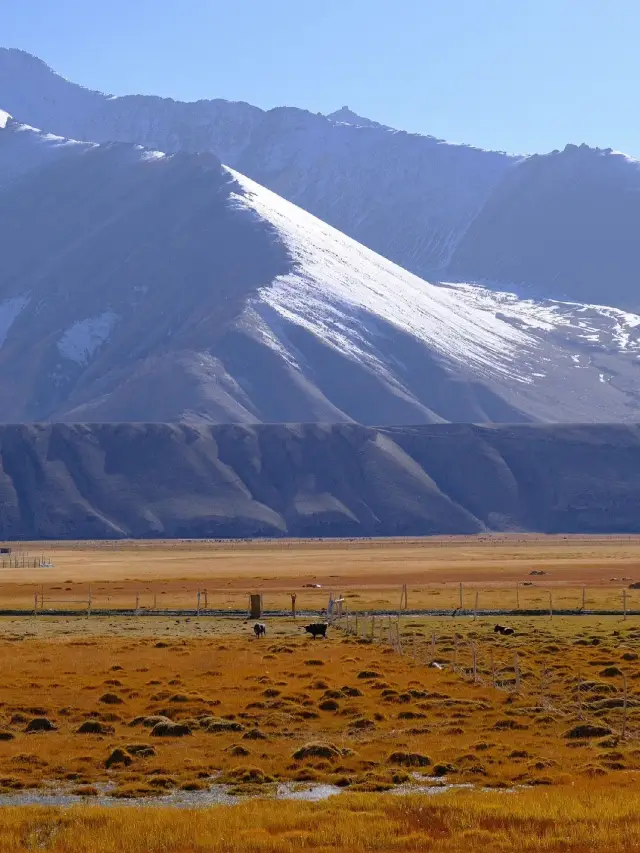
When I first entered the Pamir Plateau, I felt the yellow sand, all over the Gobi, desert and desert beaches, desert and desolate. But after slowly entering, it was found that the ecological environment on the Pamir Plateau was extremely rich, and various plants and animals were also rich in variety, and even videos of eagles flying soaring. The snow-capped mountains melted water throughout the year, pouring out a large area of natural pastures, cattle and horses, especially herds of yaks, were strong and fruitful. The green grass, the middle pond was covered with microwaves, reflecting the blue sky, white clouds, and snow-capped mountains, which were like dreams.
On the 94th day of the poor tour of China, the Pamir Plateau Pamir Plateau is Persian, meaning flat roof. The Han Dynasty of China was proportionate to the green onion, and the ancient Silk Road passed here. The Pamir Plateau spans southwest China's Xinjiang, southeast Tajikistan, and northeast Afghanistan. It is a huge mountain knot at the intersection of Kunlun, Karakoram, Hindu Kush and Tianshan Mountains. Most of the people who went to Pamirgao's original tours went to Tashkurgan Tajik Autonomous County (referred to as Ta County) in the northeast. There are Baisha Mountain Baisha Lake Scenic Area, Stone City Site, Mustag Peak (father of icebergs), Hongqilafu Port (China's only land port to Pakistan), there are also China-Pakistan border pillars 7 and spectacular national gates. Of course, there is also a very important place to check in. First sell a Guanzi ~ after entering the mountain, the first attraction is Baisha Mountain Baisha Lake. White sand mountain is also called "Xiangsha Mountain", the mountain is Brunkule Lake in front of the mountain, the mountain is ChaClark Lake, the water and grass are fat, the blue mountain is covered by white sand, half covered, and the snowy mountains on the top of the mountain and the lake under the mountain together, forming a group of beautiful pictures! Tashkurgan Stone City is one of the three most famous stone cities in the history of China. More than a thousand years ago, the people of the country of Selekur built it in 120 days. There has been prosperity and war. It stands on a large rock, at the foot of the Aral grassy beach, where the Tashkurgan River runs by. More than a thousand years ago, the Tajiks had no advanced tools, but they completed the grand and magnificent project of the Stone City in a very short time. Yesterday I had gone to the port of Ilktan, and this time I did not go to the port of Hongqila. 1. The beautiful snowy mountains on the Pamir Plateau 2. Entered the mountain 3. Baisha Mountain and Baisha Lake, at an altitude of 3663 meters 4. Baisha Mountain and Baisha Lake Group Figure 5. Stone City, about 3,000 meters above sea level 6. Stone City Inner City Site 7. Stone City Group Figure 8. Aral Cao Beach, also known as Jincao Beach 9. Modern people built with stones in the scenic area Living, living people!
A good place to travel by car. . . Panlong Ancient Road is really curved and the scenery is beautiful. . . . There are also droughts, as cute as groundhogs. . . . Baisha Lake is also really beautiful. . The only thing is that the Hongqilafu port is not directly open, which will be deducted. . .
Also, it feels that the tickets are still a bit expensive, the scenic spot is particularly small in the off-season, and it is still very good to walk around. The core area of Taxian County is not very big, and there are one-stop places to eat, drink and live nearby.