九龍村
The village of Jiulong in Moyu is located in a valley, downstream of Zhongzhai, only 10 minutes' drive from Zhongzhai. The village is backed by a cliff, facing a small river, and the river is around the S-shaped bend in front of the village. It is said that there are nine caves of different sizes on the cliff behind the village, called Jiulong Cave, which is also named after the village. The village should also want to use the signboards of traditional villages for tourism. There are also many traditional buildings that are well preserved. There is also a large billboard at the entrance of the village, which draws a tourist planning and design map. There is a large cave at the cliff about 300 meters downstream of the village. The cave is not deep, but in the middle of the cave wall, there is a small hole, a clear spring gushing out of the small hole, forming a waterfall in the hole. The spring flow is gathered at the hole into a stream, and there is a disused water raft by the stream. Once upon a time, there must have been a boudoir, and the stream was strong enough to propel heavy stone rafts. But what I saw before, the water volume was small, maybe not the water harvest period, and maybe the water volume before was larger than it is now. In the village, a small number of houses have been converted into reinforced concrete buildings, if not protected, the old buildings will gradually disappear, and the charm of traditional villages will also disappear.
MoreRecommendations Near 九龍村
九龍村 Reviews: Insider Insights and Visitor Experiences
Some reviews may have been translated by Google TranslateYou Might Also Like
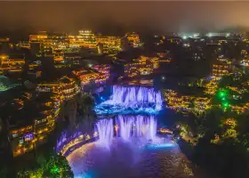
Furong Town
Tianmen Mountain
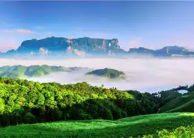
Zhangjiajie National Forest Park
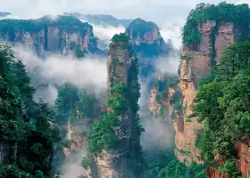
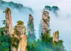
Wulingyuan
Nearby Attractions
Popular Types of Attractions in Guzhang
Popular Restaurants in Guzhang
Popular Destinations
Recommended Attractions at Popular Destinations
More Things To Do in Guzhang
Site Operator: Trip.com Travel Singapore Pte. Ltd.
The village of Jiulong in Moyu is located in a valley, downstream of Zhongzhai, only 10 minutes' drive from Zhongzhai. The village is backed by a cliff, facing a small river, and the river is around the S-shaped bend in front of the village. It is said that there are nine caves of different sizes on the cliff behind the village, called Jiulong Cave, which is also named after the village. The village should also want to use the signboards of traditional villages for tourism. There are also many traditional buildings that are well preserved. There is also a large billboard at the entrance of the village, which draws a tourist planning and design map. There is a large cave at the cliff about 300 meters downstream of the village. The cave is not deep, but in the middle of the cave wall, there is a small hole, a clear spring gushing out of the small hole, forming a waterfall in the hole. The spring flow is gathered at the hole into a stream, and there is a disused water raft by the stream. Once upon a time, there must have been a boudoir, and the stream was strong enough to propel heavy stone rafts. But what I saw before, the water volume was small, maybe not the water harvest period, and maybe the water volume before was larger than it is now. In the village, a small number of houses have been converted into reinforced concrete buildings, if not protected, the old buildings will gradually disappear, and the charm of traditional villages will also disappear.