淮河
The Huai River is located in eastern China, between the Yangtze River and the Yellow River. It is called Huaishui in ancient times, and the Yangtze River, Yellow River and Jishui are also called "Four Dudes". It is one of the seven major rivers in China. The Huai River originated from the river valley on the northwest side of Taibaiding, the main peak of the Yubai Mountain in Nanyang City, Henan Province. The dry flow flows through Henan, Anhui, Jiangsu three provinces, the total length is 1000 kilometers, the total drop is 200 meters. The flow to Huai'an Hongze Lake is downstream, there are two waterways into the Yangtze River and into the Yellow Sea Waterway, Hongze Lake to Sanjiangying is the river channel, 150 kilometers long; Hongze Lake into the sea channel is the general irrigation channel in northern Jiangsu, In the past ten years, most of the water of Huaihe River has entered the main irrigation channel in northern Jiangsu through Hongze Lake into the sea, so the Sanjiang camp is the gateway of Huaihe River and the seaside is the gateway of Huaihe River.
MoreRecommendations Near 淮河
淮河 Reviews: Insider Insights and Visitor Experiences
Some reviews may have been translated by Google TranslateYou Might Also Like
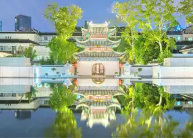
China Imperial Examination Museum (Jiangnan Gongyuan)
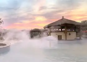
Tangshan No.1 Hot Spring Resort
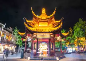
Dacheng Hall of Confucius Temple
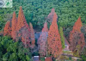
Moganshan
Nearby Attractions
Popular Types of Attractions in Xuyi
Popular Restaurants in Xuyi
Popular Destinations
Recommended Attractions at Popular Destinations
Popular Trip Moments
Popular Travel Types
More Things To Do in Xuyi
Site Operator: Trip.com Travel Singapore Pte. Ltd.
The Huai River is located in eastern China, between the Yangtze River and the Yellow River. It is called Huaishui in ancient times, and the Yangtze River, Yellow River and Jishui are also called "Four Dudes". It is one of the seven major rivers in China. The Huai River originated from the river valley on the northwest side of Taibaiding, the main peak of the Yubai Mountain in Nanyang City, Henan Province. The dry flow flows through Henan, Anhui, Jiangsu three provinces, the total length is 1000 kilometers, the total drop is 200 meters. The flow to Huai'an Hongze Lake is downstream, there are two waterways into the Yangtze River and into the Yellow Sea Waterway, Hongze Lake to Sanjiangying is the river channel, 150 kilometers long; Hongze Lake into the sea channel is the general irrigation channel in northern Jiangsu, In the past ten years, most of the water of Huaihe River has entered the main irrigation channel in northern Jiangsu through Hongze Lake into the sea, so the Sanjiang camp is the gateway of Huaihe River and the seaside is the gateway of Huaihe River.
When I first arrived in Huai'an, I was very curious to see that there was an old road of the Yellow River. How did the Yellow River stir together? It turned out that the Yellow River has been a multi-sand river since ancient times. After the Tang and Song Dynasty, the sediment increased. Some of these sediments are accumulated on the lower river bed, accumulated over the years, the river bed is silted high, all by the levees, and the river is suspended for a long time. Every time the big ripples, the light overflows, and the heavy river is relocated. According to rough statistics, the flood of the lower reaches of the Yellow River was recorded about 1,500 times before the 1950s, and there were 20 or 30 major diversions. The floods spread north to the Haihe River and South Dahuai River, straddling and crossing 250,000 square kilometers, which has a huge impact on the geographical environment of the Huanghuaihai Plain in China. So there is a saying of "the Yellow River to take Huaihuai into the sea."
[View] Good choice [View] Good choice
The Corner new exhibition really surprised me too much! The whole process is to say "Wow! so beautiful! so beautiful!" Very shocking! ! ! It is worth everyone to see! Just in the basement of the building next to Wukang Building! 6 rooms 📸 too many corners! 9 pictures can not be put out and leave some mystery for everyone to find it for themselves! 🏠: The Corner Corner [one point corner] 📍: No. 4, Lane 1950, Huaihai Middle Road 💽: 10.10 From Wednesday to Monday (only closed on Tuesday) 1pm-8pm🎫: 50r$( GREEor halfjia with relevant documents) #Worth the fare back good place #Where to go in winter #Capture the city humanities