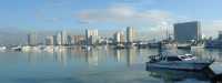
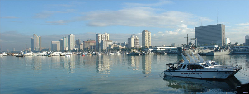
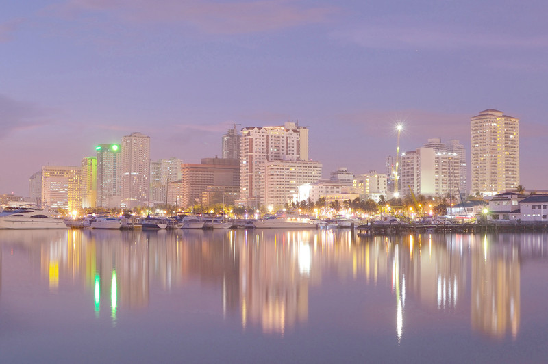
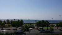
Manila Bay, the South China Sea Bay, is almost completely land-locked, located in the southwest of Luzon Island. It is one of the world's largest harbors with an area of 2,000 square kilometers (770 square miles). The widest point is 58 kilometers (36 miles). Corregidor Island, 48 kilometers (30 miles) west of Manila, divides the 18 kilometers (11 miles) wide bay entrance into two straits: the South and the north, which are safer to navigate and 3 kilometers (2 miles) wide. The northern and northeastern shores of the Gulf are connected with the central plain of Luzon, and the coastal waters are shallow. They are the largest commercial fishing grounds in the Philippines. Port Manila is located in the easternmost part of Manila Bay, including the north port for inter-island navigation and the south port for international navigation. The Bataan Peninsula and the mountains of Central Cordillera form a natural barrier, making Manila Bay an excellent anchorage. Near Southeast Asia, the Bay was commercially important as early as the Spanish colonial period in 1571. On May 1, 1898, the U.S. Army destroyed the Spanish fleet in the decisive naval battle of the American-Spanish War (the Battle of Manila Bay).
;
Manila Bay Review
4.4 /5505 Reviews


1 / 10


5/5
Manila Bay
Posted: Oct 16, 2016


20 person liked this
Like
 4/5ExcellentOriginal Text
The famous Manila Bay was once heavily polluted, and there were no natural beaches near Richa Square. In order to combat pollution and develop tourism, the local government has made a big deal and paid a big price. They brought thousands of tons of crushed dolomites from Cebu, paving the beach, improving the beach's vision, but it wasn't suitable for beach activities because it was a stone after all.
Posted: Jul 17, 20230 4/5Excellent
Twas wet and windy when we visited. Lucky to meet an enterprising vendor selling large umbrellas for 250 pesos( around usd4) and there was a tent. after a few minutes it cleared. the breeze was relaxing. a horse drawn carriage is for rent for for 500 pesos -4max.or 1000 pesos to Mall of Asia.
Posted: Jun 11, 20230 5/5Outstanding
In my mind, my highest good — defending and fighting for Manila Bay — is important work: I wouldn't be doing it otherwise. And ... ❤️🥹 my heart swells so much sometimes, Manila. On those days when there are no groups scheduled, I go to the beach alone ... I arrive ... and then I realize something: I'm NOT alone. I'm not alone in this battle. William is there — ALWAYS. I see Joy constantly. PJ. Agnes. Ghuy. I see Corazon. Aaron. I see so many Manila Bay Beach Volunteer Army members — constantly. And EVERY DAY people — people I haven't yet met, people I don't know — they watch from a distance — but after a short time, they walk up to me, talk to me, ask me who I am/what I'm doing/where I'm from ... the normal questions people are curious about ... and they START TO HELP. 🥲🥹 When I'm there — in that moment — I rarely get emotional about it: there's too much work to be done. But now ... at home ... looking at the beach through my window, well, I'm emotional. I appreciate every d@^n one of you. Sincerely. Bottom of my heart s*!t. ❤️🥹 The people I meet, the people I am fortunate enough to interact with and work beside, the people who just do what it takes ... I LOVE THOSE PEOPLE! AND ... since we are here ... I could not properly express my RESPECT, ADMIRATION, APPRECIATION and LOOOOOVE for the Philippine Mountain Rangers and Wildlife Enforcers — because they are ALL "those people" I just referenced! Talk about STEPPING UP!
Posted: Nov 18, 20220 5/5OutstandingOriginal Text
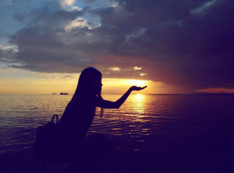
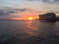
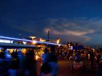
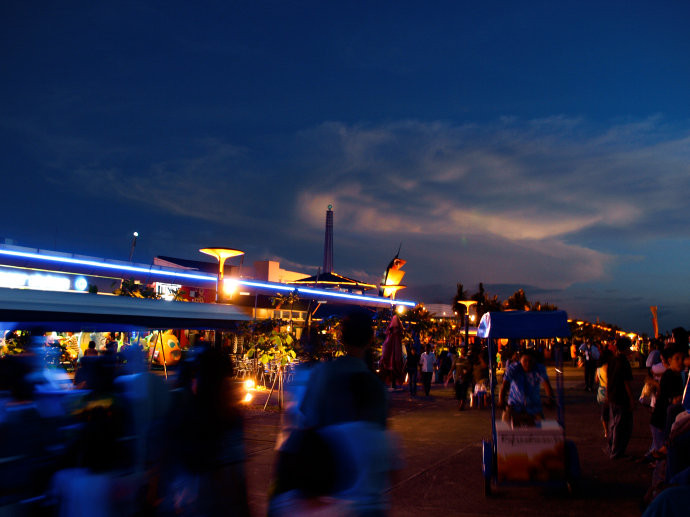
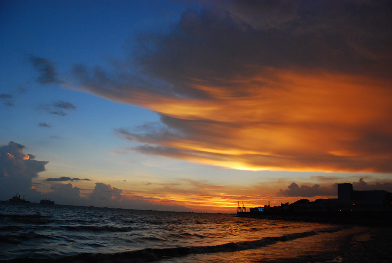
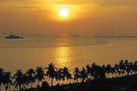
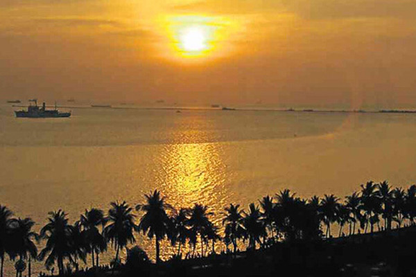
Drink a small wine and eat buffet, enjoy the beautiful sunset of Manila Bay...life small...
Posted: Aug 1, 20230 5/5OutstandingOriginal Text
The bay is very beautiful, the children like it very much, no tickets, must recommend, good
Posted: Aug 23, 20230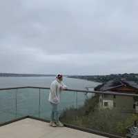 5/5OutstandingOriginal Text
Very beautiful sea wall, beautiful to see the sunset.
Posted: Aug 7, 20230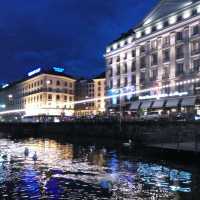 5/5OutstandingOriginal Text
Very nice place, I recommend everyone to see it
Posted: Jul 28, 20230- 1
- 2
- 3
- 4
- 100
Popular Destinations
Copenhagen Travel | Oslo Travel | Stockholm Travel | Las Vegas Travel | Carlisle Travel | United Kingdom Travel | Toronto Travel | Kota Bharu Travel | Birmingham Travel | Lake District Travel | Warsaw Travel | Montego Bay Travel | Watford Travel | Brisbane Travel | Hersonissos Travel | El Calafate Travel | Kefallinia Travel | Paralimni Travel | Loudoun County Travel | Bocas del Toro Travel | King's Lynn and West Norfolk District Travel | Anhua Travel | Honghe Travel | Forster Travel | Bacoor Travel | Curacautin Travel | Ararat Rural City Travel | Dennis Port Travel
Recommended Attractions at Popular Destinations
Bangkok attraction near me | Tokyo attraction near me | Manila attraction near me | Hong Kong attraction near me | Taipei attraction near me | Seoul attraction near me | Los Angeles attraction near me | New York attraction near me | Shanghai attraction near me | Kuala Lumpur attraction near me | Shenzhen attraction near me | Osaka attraction near me | Singapore attraction near me | Guangzhou attraction near me | London attraction near me | San Francisco attraction near me | Beijing attraction near me | Macau attraction near me | Bali attraction near me | Paris attraction near me | Ho Chi Minh City attraction near me | Orlando attraction near me | Jakarta attraction near me | Phuket attraction near me | Chicago attraction near me | Toronto attraction near me | Istanbul attraction near me | Cebu attraction near me | Dallas attraction near me | Seattle attraction near me
Popular Attractions
Beijing Zoo | Nami Island | Warner Bros. Studio Tour London | Wat Arun Ratchawararam Ratchawaramahawihan | Universal Beijing Resort | London Eye River Cruise | Shanghai Tower | Awana SkyWay | Birmingham New Street | Genting SkyWorlds Theme Park | Shanghai Wild Animal Park | Lime Street Railway Station | Patong Boxing Stadium Sainamyen | Train Sóller | Happy Valley Beijing | Huangpu River Tour(16 Pu Pier) | Tirana e Re Piramida | Great Sphinx of Giza | Roland Museum | Rogers Place | FK Graničar Riđica | Castell del Vilosell | Cyril Bassett VC Lookout | Khuang Sing Chinese Cemetery | Amazing Grace Park | Asahiseimei Hall | Assembleia de Deus Jardim Primavera | Rosenhaven | The Royal Mews, Buckingham Palace | Alton Towers Waterpark
Popular Travelogues
Bangkok Travelogue | Tokyo Travelogue | Hong Kong Travelogue | Seoul Travelogue | Los Angeles Travelogue | New York Travelogue | Shanghai Travelogue | Kuala Lumpur Travelogue | Shenzhen Travelogue | Osaka Travelogue | Singapore Travelogue | Guangzhou Travelogue | London Travelogue | San Francisco Travelogue | Beijing Travelogue | Macau Travelogue | Bali Travelogue | Paris Travelogue | Ho Chi Minh City Travelogue | Phuket Travelogue | Chicago Travelogue | Toronto Travelogue
Payment Methods
Our Partners
Copyright © 2024 Trip.com Travel Singapore Pte. Ltd. All rights reserved
Site Operator: Trip.com Travel Singapore Pte. Ltd.
Site Operator: Trip.com Travel Singapore Pte. Ltd.