


1 / 8
Mentioned in This Moment
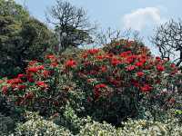
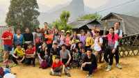
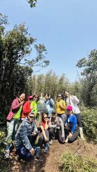
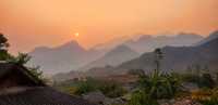
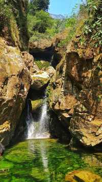
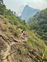
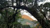
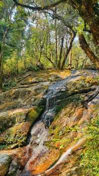
Nam Xay
View
Show More

Popular Travel Types
Popular Destinations
Thailand Travel | Prague Travel | Albania Travel | Hersonissos Travel | Cairo Travel | Brighton and Hove Travel | Agadir Travel | Kunming Travel | Maldives Travel | Wellingborough Travel | Rio de Janeiro Travel | Sao Paulo Travel | Islamabad Travel | Jakarta Travel | Orlando Travel | Guilin Travel | Georgia Travel | Drumnadrochit Travel | Bintulu Travel | Kharkiv Oblast Travel | Altdorf Travel | Uddevalla Municipality Travel | Alashanzuoqi Travel | Shari District Travel | Chepstow Travel | Minden Travel | New Braunfels Travel | Beatrice Travel | Gurugram Travel
Recommended Attractions at Popular Destinations
Bangkok attraction near me | Tokyo attraction near me | Manila attraction near me | Hong Kong attraction near me | Taipei attraction near me | Seoul attraction near me | Los Angeles attraction near me | New York attraction near me | Shanghai attraction near me | Kuala Lumpur attraction near me | Shenzhen attraction near me | Osaka attraction near me | Singapore attraction near me | London attraction near me | Guangzhou attraction near me | San Francisco attraction near me | Beijing attraction near me | Macau attraction near me | Bali attraction near me | Paris attraction near me | Ho Chi Minh City attraction near me | Orlando attraction near me | Jakarta attraction near me | Phuket attraction near me | Chicago attraction near me | Toronto attraction near me | Fukuoka attraction near me | Istanbul attraction near me | Dallas attraction near me | Cebu attraction near me
Popular Attractions
Gubei Water Town | Shanghai Disney Resort | The Shard | City of Caves | Times Square | Side | Seine River Cruise | Guangzhou Chimelong Tourist Resort | Marina Bay Sands | Aquaria KLCC | Budva Old Town | Universal Studios Japan | Prince Kung's Palace Museum | Three Natural Bridges | Dubai Helicopter Tour | Shichahai Bar Street | Royal Observatory Greenwich | Bukit Desa Damai Hiking Trail | Pingyao Ancient City | Kapersburg | Capiz Provincial Park | Mura Osche di Frosolone | Chamundeshwari Mata Temple/चामुंडेश्वरी माता मंदिर | Pawna lake | Al Eman Mosque | Tiroler See | Mountain Greens Golf Course | Yadav Farm House Tejpur | FuturZone San Juan Del Puerto | Christin Massage
Payment Methods
Our Partners
Copyright © 2024 Trip.com Travel Singapore Pte. Ltd. All rights reserved
Site Operator: Trip.com Travel Singapore Pte. Ltd.
Site Operator: Trip.com Travel Singapore Pte. Ltd.