OverviewNearbyReviewsWin PrizesRecommended
Share to
Hamaishidake
浜石岳2.1
 based on 12 reviews
Address:
Yuiaso, Shimizu-ku, Shizuoka 421-3107, Shizuoka PrefectureMap
What travelers say:

See all 6 photos
Recommendations Near Hamaishidake
Hamaishidake Reviews: Insider Insights and Visitor Experiences
Write a Review
 Trip.com
 (12 Reviews)TripAdvisor12 Reviews
You Might Also Like
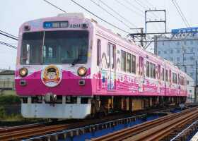
Chibi Maruko Chan Land
4.8
4.7/5123 Reviews
From €5.60
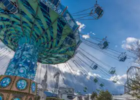
Fuji-Q Highland
6.9
4.7/5423 Reviews
From €29.14
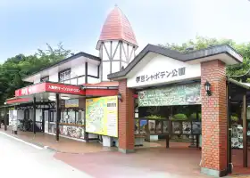
Izu Shaboten Park
5.2
4.4/545 Reviews
From €14.87

Hakone Kowakien Yunessun
5.0
4.6/593 Reviews
From €12.98
Nearby Attractions
Chibi Maruko Chan Land | Miho no Matsubara | Nihondaira | Kunouzan Toshogu | S-Pulse Dream Plaza | Sunpu Castle Park | Suruga Health Land | NEOPASA Shimizu | Shizuoka Sengen Shrine | Nihondaira Yume Terrace | Marine Science Center, Social Education Center, Tokai University | Sauna Shikiji | Satta Pass | Twin Messe Shizuoka | IAI Stadium Nihondaira | GRANSHIP | Shizuoka Prefectural Museum of Art | Toro Remains | Hirono Seaside Park | Shimizu Nihondaira Sports Park | Ofuro cafe bijinyu | Cine City Zart | Aoi Hot Spring Kusanagi no Yu | Shizuoka City Museum of Art | Abe River Fireworks | Kusanagi Sports Complex | Aoba Symbol Road | Shizuoka Prefecture Gokoku Shrine | Dream Ferry | Satta-toge Pass Observation Deck
Popular Types of Attractions in Shizuoka
Parks | City Parks | Amusement Parks | Botanical Gardens | Religious Sites | Other Places of Worship | Temples | Churches and Cathedrals | Exhibition Centers | Museums | Art Museums | Art Galleries | Lifestyle | Hot Springs | Entertainment Centers | Libraries | Architecture & Landmarks | Monuments | Featured Neighborhoods | landmark | Historic Sites | Historical Sites | Castles | Cemeteries | Popular Spots | Nature | Lakes | Mountains | Attractions | Outdoor Sports
Popular Restaurants in Shizuoka
All Day Dining The Terrace | Binchoh Ogiya Shizuoka SBS Tohriten | Kawakyo | まぐろ丼専門店 清水港 みなみ | Chojiya | Tsuruya | Gongben he'anzhishidian | Hama no Kakiageya | Nihonryourikarin | Togakushi Soba Honten | Cyakkiriya | Quil Fait Bon Shizuoka | Sawayaka Shizuoka Ikeda | La Avenir | Teppanyakikeyaki | Huusuiju | Kodona | SMILE Shimizuten | TSUTANO | Numazuogashizushi Puremiamu Shizuokahonten | Hatchogura Shizuokaasuteiten | Roido Shizuokaasuteiten | Okonomiyakihompo Shizuokasena | Gyu-Kaku Shizuokaesubiesudoriten | Bakagai | LAPIS AZUR | Nakotei | ATO | Abekawa-no Hotori Shiki-no Sachi Edokoma | Manten
Popular Destinations
Philippines Travel | Kuala Lumpur Travel | Lahore Travel | Riyadh Travel | New York Travel | Tehran Travel | Switzerland Travel | Stockholm Travel | Ayia Napa Travel | Colombo Travel | Castellon de la Plana Travel | Toronto Travel | Chongqing Travel | Doncaster Travel | Carlisle Travel | Capri Travel | Shenyang Travel | South Shields Travel | Tamiami Travel | Batticaloa Travel | Foshan Travel | Loudoun County Travel | Bocas del Toro Travel | King's Lynn and West Norfolk District Travel | Anhua Travel | Honghe Travel | Forster Travel | Dengfeng Travel
Recommended Attractions at Popular Destinations
Bangkok attraction near me | Manila attraction near me | Tokyo attraction near me | Hong Kong attraction near me | Seoul attraction near me | Taipei attraction near me | Los Angeles attraction near me | New York attraction near me | Shanghai attraction near me | Kuala Lumpur attraction near me | Shenzhen attraction near me | Osaka attraction near me | Singapore attraction near me | London attraction near me | Guangzhou attraction near me | San Francisco attraction near me | Beijing attraction near me | Macau attraction near me | Bali attraction near me | Paris attraction near me | Orlando attraction near me | Jakarta attraction near me | Ho Chi Minh City attraction near me | Chicago attraction near me | Phuket attraction near me | Toronto attraction near me | Cebu attraction near me | Istanbul attraction near me | Dallas attraction near me | Seattle attraction near me
Popular Ranked Lists
Popular Luxury Hotels Near Gabicce Mare | Popular Luxury Hotels Near Kopeng | Popular Fine Dining in Shenzhen | Popular Fine Dining in Kyoto | Popular Premium Hotels in Yulin | Popular Luxury Hotels Near Newport | Popular Premium Hotels in San Fernando | Popular Premium Hotels in Vargas | Popular Luxury Hotels Near Milan | Top 20 Local Restaurants in Las Vegas | Top 5 Bars in Changzhou | Popular Fine Dining in Paris | Popular Nightlife Districts in Jinghong | Popular Family-friendly Attractions Near Houma | Popular Family-friendly Attractions Near Sunan | Top 5 Fine Dining in Guiyang | Top 8 Fine Dining in Qingdao | Popular Family-friendly Attractions Near Pingyuan | Popular Family-friendly Attractions Near Xincai | Top 11 Premium Hotels in Zhangjiakou | Popular Family-friendly Attractions Near Jingning | Popular Luxury Hotels Near St. Helena | Popular Fine Dining in Macau | Popular Fine Dining in Dubai | Popular Premium Hotels Near Cajamarca | Popular Fine Dining in Tokyo | Popular Nightlife Districts in Las Vegas | Top 5 Fine Dining in Phuket | Top 4 Nightlife Districts in Tokyo
Popular Trip Moments
Bridge of Dreams: Poetry and Distance under Mount Fuji | Numazu City's First Permanent Kinnikuman Exhibition | Nihondaira Zoo 🇯🇵 | Shizuoka, Japan | Fresh Breezes and Sakura | Shizuoka City Museum of Art | Sunpu Castle Park Momijiyama Garden | Kunōzan Tōshōgū Museum | Sumpu Castle Park | Nihondaira | Toro Park | A Glimpse of Grandeur: Mount Fuji from Shizuoka | Seeizawa Keisuke Art Museum | Toro Park | Nihondaira Yume Terrace | Shizuoka Sengen Shrine | Nihondaira Zoo | Shizuoka's sacred place | fuji mountaun | Hidden gem Fuji Mountain location and unlocking the fourth Fuji Mountain view hotel in life | BAKE The SHOP | Pure Water Temple | Fuji Mt Observatory in Shizuoka 🗻 | Travel food and photography | Seaside beauty | Beautiful scenery on the way to Shizuoka business trip. | Shizuoka Travel Notes | Come to Shizuoka to see cherry blossoms!
Popular Travel Types
More Things To Do in Shizuoka
Japan eSIM Day Pass/Data Package (QR Code) | [Japan] DOCOMO eSIM Data Package QR code | Soy sauce making experience tour | Japan Shizuoka Chibi Maruko-chan Land + Miho no Matsubara + Kunou Shantōshogu Shrine + Sunpu Castle Park one-day tour [door-to-door pick-up and drop-off Chinese service] | Mt.Fuji Chartered Taxi Tour | 3-Hour Gotemba Food and Nightlife Izakaya Walking Tour | Shizuoka/Shimizu Mt Fuji View 6 hr Private Tour: Guide Only | Sightseeing around Shimizu Port for cruise ship passengers | Lake Tanuki, Shiraito Falls, Sengen Shrine from Shimizu Port | Zen Experience and Walking Tour to Gotemba Local Hidden Gems | Atami Half-Day Private Tour with Government-Licensed Guide | Atami Full-Day Private Tour with Government-Licensed Guide | Japan Yamanakako One-Day Tour [KABA BUS/Swan Lake Cruise + Oshino Hakkai + Kawaguchiko + Lawson] | Japan Mount Fuji One-Day Tour [VIP Chartered Vehicle/ Hotel Pick-up/Intimate Service] | Japan Mt. Fuji + Oshino Hakkai + Hakone Owakudani One-Day Tour [VIP Chartered Vehicle/ Hotel Pickup/Intimate Service] | Japan Mt. Fuji + Makaino Ranch One-Day Tour [Kawaguchiko + Makaino Ranch Family Tour] | [Net Yuan Cuisine Tokzo Maru Uoan] Kinmei sea bream set meal (reservation only) | Japanese CountrySide Fishing Tour In Shizuoka | Japan Meguro River Hakone+Izu Sea View Train+Kinosaki Coast+Kawazu Sakura+Chibi Maruko-chan Paradise+Kyoto Arashiyama+Nara Park Six-Day Charter Tour | Mt. Fuji + Shizuoka Sengen Shrine Day Tour [(Runjing River Ryukaifuchi + Iwamotoyama Park) Tokyo Cherry Blossom Viewing Special Line + City Round Two-way] | Japan Tokyo + Mt. Fuji Hongu Sengen Taisha + Shizuoka Prefecture Mt. Fuji World Heritage Center + Chibi Maruko-chan Land One-Day Tour [Chinese Special Car-Door Pickup-Fuji Panorama] | Kawaguchiko + Arakurayama Sengen Park + Kawaguchiko Tenjoyama Park + Oshino Hakkai Day Tour [Mount Fuji/Chinese Special Car/Adjustable Itinerary] | [Net Yuan Cuisine Tokzo Maru Shimoda Branch] Kinmei sea bream set meal (reservation only) | Japan Meguro River+Hakone+Izu Sea View Train+Kinosaki Coast+Kawazu Sakura+Chibi Maruko-chan Paradise+Kyoto Arashiyama+Nara Park Six-Day Charter Tour | Japan Meguro River+Hakone+Izu Sea View Train+Kinosaki Coast+Kawazu Sakura+Chibi Maruko-chan Paradise+Kyoto Arashiyama+Nara Park Five-Day Charter Tour | Japan Meguro River+Hakone+Izu Sea View Train+Kinosaki Coast+Kawazu Sakura+Chibi Maruko-chan Paradise+Kyoto Arashiyama+Nara Park Five-Day Charter Tour | Japan Meguro River+Hakone+Izu Sea View Train+Kinosaki Coast+Kawazu Sakura+Chibi Maruko-chan Paradise+Kyoto Arashiyama+Nara Park Five-Day Charter Tour | Japan Meguro River+Hakone+Izu Sea View Train+Kinosaki Coast+Kawazu Sakura+Chibi Maruko-chan Paradise+Kyoto Arashiyama+Nara Park Six-Day Charter Tour | Japan Tokyo + Shizuoka Prefecture Mount Fuji World Heritage Center + Miho Matsubara Coast (Qingmizu Coast) One-Day Tour [Immersive Mount Fuji Experience-Chinese Special Car-Door Pickup] | One-day trip to Kinkakuji Temple + Kiyomizu Temple + Fushimi Inari Taisha Shrine in Japan [You can experience Hanbok at your own expense, upgraded Hotel pick-up, Japanese style and ancient charm]
Payment Methods
Our Partners
Copyright © 2024 Trip.com Travel Singapore Pte. Ltd. All rights reserved
Site Operator: Trip.com Travel Singapore Pte. Ltd.
Site Operator: Trip.com Travel Singapore Pte. Ltd.
Beautiful panoramic view
You can enjoy a 360 view. On a clear day, you can admire Fuji san, the suruga bay, Izu peninsula, Shimizu Port, Miho peninsula. From The main parking lot,it only takes about 40 mn away to hike to the...
Clear weather, climb Mt. Hamaishi
It was a little cold, but I had a business to go to Kambara by light truck, and then I attacked a partially unpaved forest road to Mt. Hamaishi and approached the radio tower by car. From here, climb the steep stairs by 5 and you will reach the top of Mt. Hamaishi at altitude 707m. From the top, wonderful scenery such as the Southern Alps mountain range, Mt. Fuji, Izu Hakatsu , and Shimizu Port is 360 degrees and is a superb view.
Climbing from the Fuji gawa River side to hamaishi Dake in the fog
Hamaishidake is usually driven from Yui to the parking lot just below the summit, but we aimed for Yui with a 4WD light tiger on a steep and narrow forest road along National Highway 52 from the Fuji River. During the rainy season, finally climb the sugano route on the east side of hamaishi Dake and reach the top. If it is sunny, it is a 360 degree view, but when it is covered with fog and the fog is barely lost by the wind, it can be seen in the direction of Fuji and Shimizu Port. 707 meters above sea level, hiking is easy, but ...
Quite a walk but a great view
I walked a lot in search of a superb view of Mt. Fuji. The scenery is really good. Mt. Fuji seen from a slightly higher place is also good.
707m
I walked 8 km from Yui Station. There is a road where cars can pass to the top of the mountain, but finally there is a mountain trail route via Sanbonmatsu. From the top of the mountain, you can enjoy a panoramic view of Mt. Fuji, Suruga Bay, and the Southern Alps.