OverviewBookNearbyReviewsWin PrizesRecommended
Share to
Pamirs Plateau
帕米爾高原6.7
761 Reviews
Open Opens at 08:30-20:30
Recommended sightseeing time:2-3 days
Address:
Pamir Mountains, ChinaMap
What travelers say:
The scenery of the Pamir Plateau is infinitely worth a visit! This road is snowy mountains, glaciers, grasslands, cattle and sheep, camels, deserts, and lakes under the blue sky and white clouds! And Xinjiang specialties are so fragrant! Great beauty Xinjiang! ! !
More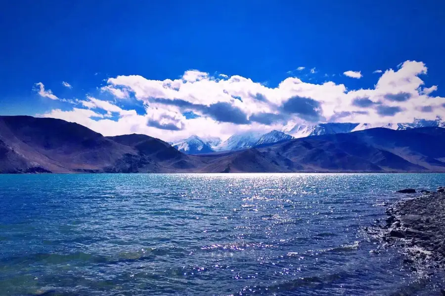
See all 55 photos
Saved by 30
Need to know
View More
Pamirs Plateau Highlights: Must-See Features and Attractions
Some information may have been translated by Google Translate
Pamirs Plateau is located in West China, extending across Tajikistan, China and Afghanistan. Consisting of East and West parts, Pamirs Plateau has a number of high mountains. East Pamirs is broad and level, formed by two mountain ranges oriented from northwest to southeast and a group of rivers, valleys, lakes and basins. West Pamirs is formed by multiple mountains and valleys running in parallel from northeast to southwest. West Pamirs is distinguished by its varied terrain, with high mountains and deep valleys.
Recommendations Near Pamirs Plateau
Pamirs Plateau Reviews: Insider Insights and Visitor Experiences
Some reviews may have been translated by Google TranslateWrite a Review
/5
Outstanding ReviewsAll (761)
Latest
With Photos (575)
Verified Booking (23)
Positive Reviews (322)
Negative Reviews (3)
- 1
- 2
- 3
- 4
- 100
Pamirs Plateau Photos: Trip Moments
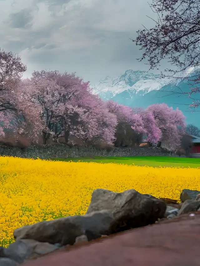 Where to go in April, highly recommendedApril is the best time to travel!!! April in spring, a good season! It's the perfect time to see the flowers! Here, I recommend a few places of poetry and distance for everyone. At the end of March and the beginning of April every year, this place will be the most beautiful. 1️⃣ The first place: Peach blossoms in Linzhi, Tibet, known as the 'Little Jiangnan' of Tibet, is really healing! Every year from the end of March to the beginning of April, from 3.15 to 4.15, the Linzhi area is a peach blossom paradise. Snow-capped mountains, peach trees, and barley fields, the villages are like a secret realm, where one could stay for a whole day. 2️⃣ The second place: Apricot blossom villages such as the ancient Tashkurgan Trail and Datong Township in the Pamir Plateau region of Xinjiang. The exotic charm here hides quaint villages, and the mountains and rivers here are full of life in this spring. The ancient apricot trees, with the end of March being the best time to view the blossoms. 3️⃣ Xinjiang Yili Turgen Apricot Blossom Valley, where apricot trees cover the mountains and valleys. The spring here is the most beautiful, in early April, around Qingming, a brief week, interpreting the fairy tale of spring. 🔥 The above three places are the must-visit checkpoints for the spring travel ceiling. If you also long for the spring here, then let's go together!gwendolyn_juniperhale
 Mustagh AtaI touched the glacier at zero distance in southern Xinjiang Mustagh Ata No. 4 Glacier Park Compared with No. 1, 2, 3 glaciers, the biggest advantage of No. 4 is that it is suitable for people with poor health and high anti, the difficulty of arrival is much lower, there is a bus from the ticket office below to the middle, the section that needs to be climbed can also ride a horse up, basically as long as you spend 290, you can comfortably go up and down. In winter, the lake in front of the glacier freezes and you can walk on it, infinitely close to the glacier, there are icicles hanging on the side of the glacier, what needs to be noted here is that they may fall at any time. If you are not a particularly serious high anti crowd, it is still recommended to climb, the horse riding road and the walking road are not the same, the walking road has more slopes, and it is not very steep, if you are tired from climbing, you can look back and see the mountains on the opposite side of Figure 7. :💳+🚌90 Round trip horse riding 200 🔼You need to prepare cash, there is no signal at all above 📷Fuji xs10+50230ElizabethHolmes35
 Discover the Pamir Plateau→A must-collect for travel enthusiastsDiscover the Pamir Plateau The only county in China with a Caucasian population On the Pamir Plateau, there is a county town with an average altitude of over 4000 meters, where China's only Caucasian population resides. It is called Tashkurgan, also known as Taxkorgan County. This place borders Afghanistan, Pakistan, and Tajikistan, and has been rated by National Geographic as the most impressive county town. It is like a dazzling pearl inlaid on the Pamir Plateau. Here, you can find snow-capped mountains that greet the wind, the pastoral fields of Tyan Song where herds of cattle and sheep roam, the mysterious and majestic Kunlun Mountain area, and the roof of the world, the Pamir Plateau, which is the ancestor of all mountains and the source of all waters. Within the territory of Taxkorgan County, there are 4 peaks over 8000 meters high, accounting for one-third of the world's total, and their majestic and spectacular sights are breathtaking. The Karakoram Highway, like a giant dragon, winds through this magical land, with over 100 peaks along the way that exceed 7000 meters in altitude. Glacial meltwater nourishes the lush grasslands, creating a paradise for wild animals and providing pastures essential for the survival of nomadic peoples. The Tajik people, known as 'the people above the clouds,' not only attract attention with their unique culture and traditions but also shoulder the important mission of guarding the frontier, closely connected to this land. Let us walk into the snow mountains together, feel their majesty and tranquility, and follow the Karakoram Highway into Taxkorgan County, to experience the Tajik people's love and commitment to this land. Follow me to explore the unique beauty of Xinjiang.isold_1830
 Explore the Pamir Plateau → A must-comment spot for travel enthusiastsExplore the Pamir Plateau The only county in China with a Caucasian population On the Pamir Plateau, there is a county town with an average altitude of over 4000 meters, which is home to China's only Caucasian population. It is called Tashkurgan, also known as Taxkorgan County. This place borders Afghanistan, Pakistan, and Tajikistan, and has been rated by National Geographic as the most impressive county town. It is like a dazzling pearl set on the Pamir Plateau. Here, you can find snow-capped mountains welcoming the wind, herds of cattle and sheep on the Tian Ge pasture, the mysterious and lofty Kunlun mountain area, and the roof of the world, the Pamir Plateau, which is the ancestor of all mountains and the source of all rivers. Within the territory of Taxkorgan, there are 4 peaks over 8000 meters high, accounting for one-third of such peaks worldwide, and their majestic and spectacular scenery is breathtaking. The Karakoram Highway, like a giant dragon, winds through this magical land, with over 100 peaks exceeding 7000 meters in altitude along the way. Glacial meltwater nourishes the lush grasslands, becoming a paradise for wild animals and providing pastures essential for the survival of nomadic peoples. The Tajik people, known as the 'People above the clouds', not only draw attention with their unique culture and traditions but also shoulder the important mission of guarding the frontier, closely connected to this land. Let us walk into the snow mountains together, feel their majesty and tranquility, and follow the Karakoram Highway into Taxkorgan, to experience the Tajik people's love and commitment to this land. Follow me to discover the unique beauty of Xinjiang.brynn_6879
 Pamir Plateau Travel Guide!!!Itinerary DAY1⃣️ 📍Kashgar (depart at 10:00) 📍Oytag Glacier Park (arrive at 12:40, depart at 13:50) 🗻Altitude: 2804 🎫: 45 + shuttle bus 6 yuan 📝: On the way, you will see beautiful snow-capped mountains surrounding you. After arriving at the scenic area, take a shuttle bus to the foot of the mountain. To climb further, you need to walk another 1-2km. (If you plan to visit Kanas later, you can skip this part) 📍White Sand Lake (arrive at 16:02, depart at 16:40) Half vast white sands and half clear blue waters, it's like a fairyland. 🗻Altitude: 3300 🎫30/person, yak🎫: 30/person There are free attractions to see, and you can also ride a yak along the lake for a scenic journey. 📝: There are many small flies on the yaks, but don't worry, they don't bite and will follow you after the ride 📍Karakul Lake (arrive at 17:43, depart at 18:20) 🗻Altitude: 3600 🎫45/person 📝: There are beautiful plank roads, and you can see the Mustagh Ata peak, which is very stunning, but due to the high altitude, it is not recommended to ride horses 📍Mustagh Ata Peak (arrive at 18:50) 🗻Altitude: 4000+ 🎫40/person, shuttle bus 50/person, 20 minutes by car, then a walk of about 1 kilometer. 📝: The park closes at 18:00, we arrived late and only took photos from outside. Self-driving friends should set off earlier 🥹At this time, I was seriously suffering from altitude sickness in the car, and the photos were taken by a friend 📍🏠: Checked into Taxkorgan at 19:47 The sunset is super beautiful, and you can enjoy a steaming hot pot. It's quite cold at night, it's recommended to wear long-sleeve pajamas and pants, and wear a fleece-lined jacket when going out DAY2⃣️ 📍Depart from Taxkorgan at 10:00 📍Pass by the Wakhan Corridor 📍Panlong Ancient Path 11:00-13:10 (we might have run a bit fast) 🗻Altitude: 3000-4300 📝: Have breakfast before setting off. Prepare motion sickness medicine, altitude sickness medicine, and oxygen bottles, as there are over 600 turns on the way🥹 📍Bandier Blue Lake (Xia Ban Di Reservoir) Arrive at 13:50, return at 15:00 🗻Altitude: around 3000 The weather is super nice and the scenery is super beautiful! There is a path below, you can walk to the lakeside 🚗: Return trip Return to Kashgar via the G314 national highway, passing by Mustagh Ata Peak and White Sand Lake. 📝Tips: ①High altitude can cause altitude sickness, so keep your movements small and prepare oxygen tanks before setting off, as they are quite expensive in the scenic areas ②Bring a sports watch/pulse oximeter to monitor your condition in real-time and go to the hospital if you feel very unwell! ③Prepare food, as when traveling in Xinjiang, you're usually on the road ④Bring warm clothes, as the temperature can drop to as low as 6℃ at nightGabriel.Jenkins.95
 Exploring the Pamir Plateau → Travel SharingExploring the Pamir Plateau The only county in China with a Caucasian population On the Pamir Plateau, there is a county town with an average altitude of over 4000 meters, where China's only Caucasian people live. It is called Tashkurgan, also known as Taxkorgan County. This place borders Afghanistan, Pakistan, and Tajikistan, and has been rated by National Geographic as the most extraordinary county town. It is like a dazzling pearl set on the Pamir Plateau. Here, there are snow-capped mountains welcoming the wind, the Tian Ge Pasture with herds of cattle and sheep, the mysterious and majestic Kunlun Mountain area, and the Pamir Plateau, known as the ancestor of mountains and the source of rivers. Within the territory of Taxkorgan, there are 4 peaks over 8000 meters high, accounting for one-third of the world's total, and their majestic and spectacular sights are breathtaking. The Karakoram Highway is like a giant dragon winding through this magical land, with over 100 peaks along the way that exceed 7000 meters in altitude. Glacial meltwater nourishes the lush grasslands, becoming a paradise for wild animals and providing pastures for the nomadic people to survive on. The Tajik people, known as the 'People above the clouds,' not only attract attention with their unique culture and traditions but also carry the important mission of guarding the frontier, closely connected to this land. Let us walk into the snow mountains together, feel their majesty and tranquility, follow the Karakoram Highway into Taxkorgan, and experience the Tajik people's love and commitment to this land. Follow me to discover the unique beauty of Xinjiang.Thrill-SeekingTraveler
 Explore the Pamir Plateau → A must-like for travel enthusiastsExplore the Pamir Plateau The only county in China with a Caucasian population On the Pamir Plateau, there is a county town with an average altitude of over 4000 meters, inhabited by China's only Caucasian people, known as Tashkurgan, or simply Taxkorgan County. This place borders Afghanistan, Pakistan, and Tajikistan, and has been rated by National Geographic as the most extraordinary county town. It is like a dazzling pearl set upon the Pamir Plateau. Here, you can find snow-capped mountains welcoming the wind, the pastoral fields of Tyan Song with herds of cattle and sheep, the mysterious and majestic Kunlun mountain area, and the roof of the world, the Pamir Plateau, which is the ancestor of all mountains and the source of all waters. Within the territory of Taxkorgan County, there are 4 peaks over 8000 meters high, accounting for one-third of the world's total, and their majestic and spectacular scenery is breathtaking. The Karakoram Highway, like a giant dragon, winds through this magical land, with over 100 peaks along the way that exceed 7000 meters in altitude. Glacial meltwater nourishes the lush grasslands, creating a paradise for wildlife and providing pastures essential for the survival of nomadic peoples. The Tajik people, known as the 'Household in the Clouds,' are not only notable for their unique culture and traditions but also bear the important mission of guarding the frontier, closely connected to this land. Let us walk into the snow mountains together, feel their majesty and tranquility, follow the Karakoram Highway into Taxkorgan County, and experience the Tajik people's love and dedication to this land. Follow me to discover the unique beauty of Xinjiang.FELICITY NORMAN
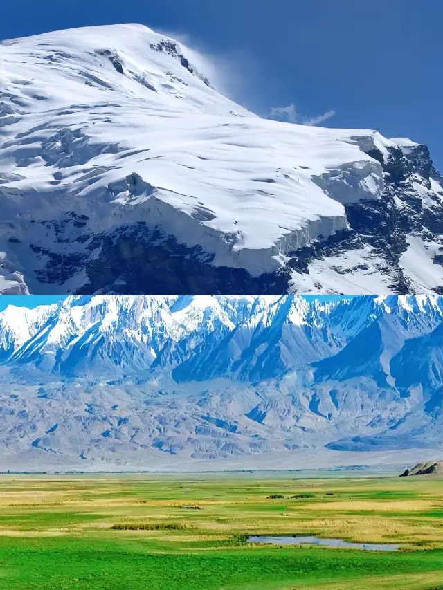
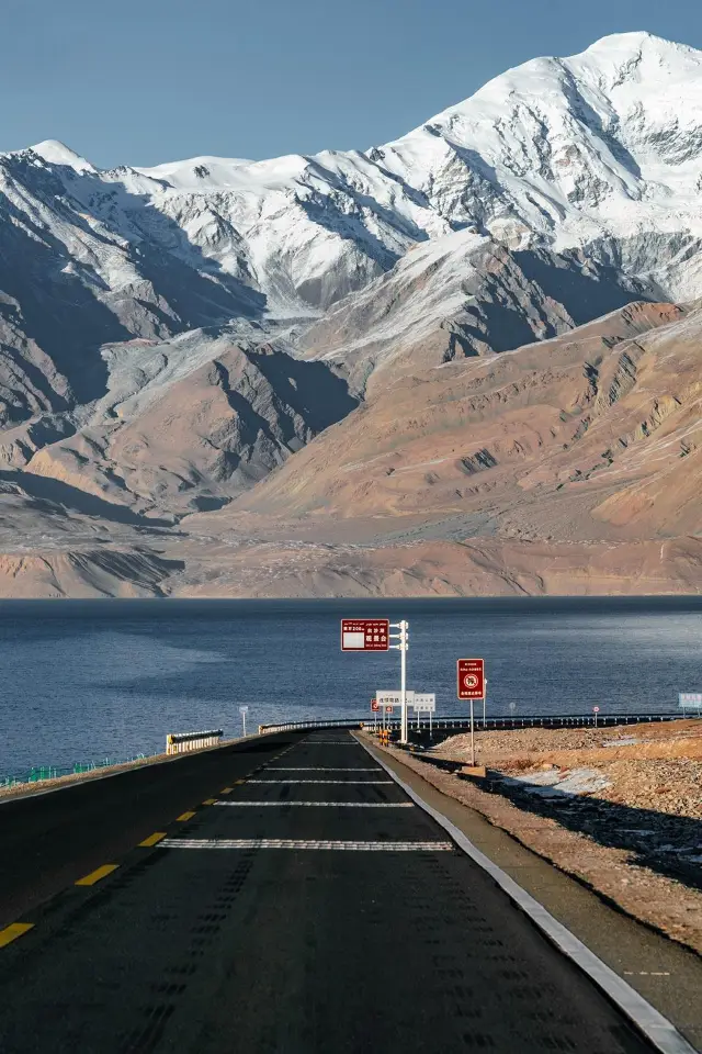
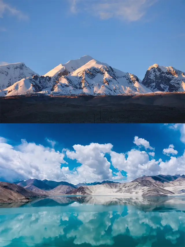
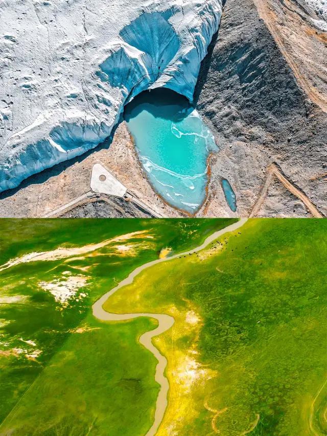
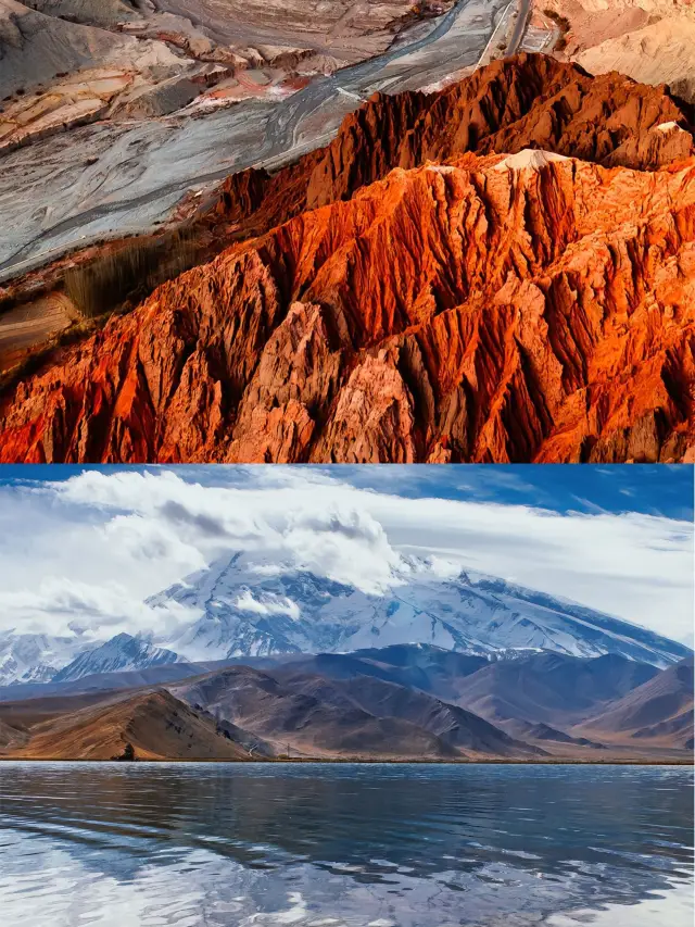
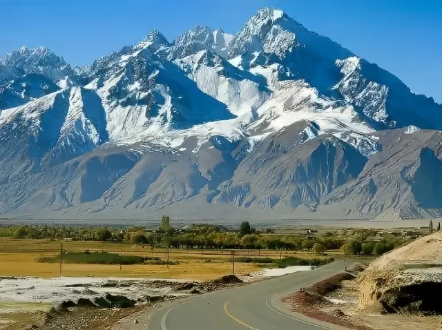 The Pamir Plateau, the only plateau in XinjiangThe Pamir Plateau, in Persian, means 'the roof of the world'. In ancient China, it was known as the Congling, and the ancient Silk Road passed through it. It is located in the southeastern part of Central Asia, at the westernmost point of China, spanning Tajikistan, China, and Afghanistan. The Pamir Plateau stretches across the southwestern part of Xinjiang in China, the southeastern part of Tajikistan, and the northeastern part of Afghanistan, and is a massive mountain junction where the Kunlun Mountains, the Karakoram Mountains, the Hindu Kush, and the Tianshan Mountains meet. It covers an area of about 100,000 square kilometers. The Pamir Plateau has towering mountains with an average altitude of over 4,500 meters, and its main peaks are all above 6,000 meters. The highest peak in the western part within Tajikistan is the Communism Peak at 7,495 meters, followed by Lenin Peak at 7,134 meters. There is a significant difference between the eastern and western parts. The western Pamir has both high absolute and relative heights; the latitudinal and longitudinal mountain ranges crisscross each other, creating a complex terrain with the characteristics of a high mountain plateau; the river network is dense, with deep cuts, and the planation surfaces are severely damaged. The eastern Pamir Plateau has a lower absolute height and relative height, with significant plateau features and broad valleys. The plateau is widely covered with glaciers, totaling 1,085, covering an area of 8,041 square kilometers. The longest Fedchenko Glacier is 77 kilometers long. There are numerous glacial lakes, with the largest being Lake Karakul, covering an area of 383 square kilometers and reaching a depth of 236 meters.JOHANNA JOSEPH
 Explore the Pamir Plateau → If you like, please leave a messageExplore the Pamir Plateau China's only county with a Caucasian population On the Pamir Plateau, there is a county town with an average altitude of over 4000 meters, where China's only Caucasian population resides. It is called Tashkurgan, often referred to simply as Taxkorgan County. This place borders Afghanistan, Pakistan, and Tajikistan, and has been rated by National Geographic as the most extraordinary county town. It is like a dazzling pearl set upon the Pamir Plateau. Here, you can find snow-capped mountains welcoming the wind, herds of cattle and sheep on the Tian Ge pasture, the mysterious and majestic Kunlun mountain range, and the world's rooftop, the Pamir Plateau, which is the ancestor of all mountains and the source of all rivers. Within the territory of Taxkorgan County, there are 4 peaks over 8000 meters high, accounting for one-third of such peaks worldwide, and their majestic and spectacular sights are breathtaking. The Karakoram Highway, like a giant dragon, winds through this magical land, with over 100 snow-capped mountains along the way that are more than 7000 meters high. Glacial meltwater nourishes the lush grasslands, creating a paradise for wildlife and providing pastures essential for the survival of nomadic peoples. The Tajik people, known as the 'People above the Clouds,' not only draw attention with their unique culture and traditions but also carry the important mission of guarding the frontier, closely connected to this land. Let us walk into the snow mountains together to feel their majesty and tranquility, and follow the Karakoram Highway into Taxkorgan County to experience the Tajik people's love and commitment to this land. Follow me to discover the unique beauty of Xinjiang.Gastronomic Adventures
 If you haven't been to Southern Xinjiang, you won't know the beauty of Xinjiang - the Pamir PlateauThe mysterious Pamir. If you haven't been to Xinjiang, you won't know the vastness of China; if you haven't been to Southern Xinjiang, you won't know the beauty of Xinjiang. Southern Xinjiang is not only a place to see culture, but also scenery. Southern Xinjiang has the White Sand Lake, which is half white sand and half lake, the majestic Gongger Peak and Jiubie Peak, the Muztagh Peak known as the 'Father of Ice Mountains', the rugged Panlong Ancient Road, the Bandir Blue Lake, the Yarkand River, and the exotic Kashgar Old City. The snow mountains of the Pamir Plateau are so close that they seem to be within reach, and the emerald-like lakes change with the weather and angle at any time, everything is so beautiful that it makes people intoxicated ☺️ This winter, come to Southern Xinjiang for a visit.bittererbrianna31
 Explore the Pamir Plateau→Save the messageExplore the Pamir Plateau The only county in China with a Caucasian population On the Pamir Plateau, there is a county town with an average altitude of over 4000 meters, inhabited by China's only Caucasian population, which is Tashkurgan, also known as Taxkorgan County. This place borders Afghanistan, Pakistan, and Tajikistan, and has been rated by National Geographic as the most extraordinary county town. It is like a dazzling pearl inlaid on the Pamir Plateau. Here you can find snow-capped mountains welcoming the wind, the Tian Ge pasture with herds of cattle and sheep, the mysterious and majestic Kunlun Mountains, and the Pamir Plateau, known as the 'Roof of the World', the ancestor of all mountains and the source of many rivers. Within the territory of Taxkorgan, there are 4 peaks over 8000 meters high, accounting for one-third of the world's total, and their majestic and spectacular scenery is breathtaking. The Karakoram Highway is like a giant dragon winding through this magical land, with over 100 peaks along the way that are more than 7000 meters high. The glacial meltwater nourishes the lush grasslands, creating a paradise for wildlife and providing pastures essential for the survival of nomadic peoples. The Tajik people, known as the 'People above the Clouds', not only attract attention with their unique culture and traditions but also carry the important mission of guarding the frontier, closely connected to this land. Let us walk into the snow mountains together, feel their majesty and tranquility, follow the Karakoram Highway into Taxkorgan, and experience the Tajik people's love and commitment to this land. Follow me to discover the unique beauty of Xinjiang.Samuel Kingsley
 Explore the Pamir Plateau→Please like and saveExplore the Pamir Plateau The only county in China with a Caucasian population On the Pamir Plateau, there is a county town with an average altitude of over 4000 meters, where China's only Caucasian people live. It is called Tashkurgan, also known as Taxkorgan County. This place borders Afghanistan, Pakistan, and Tajikistan, and has been rated by National Geographic as the most impressive county town. It is like a dazzling pearl set on the Pamir Plateau. Here, there are snow-capped mountains welcoming the wind, the Tian Ge Pasture with herds of cattle and sheep, the mysterious and majestic Kunlun Mountain area, and the Pamir Plateau, known as the ancestor of all mountains and the source of all waters. Within the territory of Taxkorgan, there are 4 peaks over 8000 meters high, accounting for one-third of the world's total, and their majestic and spectacular scenery is breathtaking. The Karakoram Highway is like a giant dragon winding through this magical land, with over 100 peaks along the way that exceed 7000 meters in altitude. Glacial meltwater nourishes the lush grasslands, becoming a paradise for wildlife and providing pastures essential for the survival of nomadic peoples. The Tajik people are known as the 'People above the clouds' and attract attention not only for their unique culture and traditions but also for their important mission of guarding the frontier, closely connected to this land. Let us walk into the snow mountains together, feel their majesty and tranquility, follow the Karakoram Highway into Taxkorgan, and experience the Tajik people's love and commitment to this land. Follow me to discover the unique beauty of Xinjiang.athena.cordelia.willowdale
- 1
- 2
- 3
You Might Also Like
Pamir Tourist Area
5.8
4.5/578 Reviews
The Ancient Stone Town of Kashgar
5.7
4.4/5222 Reviews
Nearby Attractions
Pamir Tourist Area | The Ancient Stone Town of Kashgar | Alar National Wetland Park | Tashiku'erganzhen | 慕士塔格風景區 | Viewing Platform of Taherman Wetland Park | 下阪地水庫 | 坎爾洋村 | 班迪爾藍湖 | Tashenku'ergan Tajike Zizhixian Museum | 塔吉克民俗村 | Tashenku Erganxian Museum | Taheman Township | 帕米爾金草灘 | Tizinapu Village | 塔合曼濕地 | 塔什庫爾幹縣歐羅巴温泉莊園 | 帕米爾金草灘-觀景台 | 曲什曼拜火教遺址 | 塔吉克民俗文化展示園 | 阿拉爾金草灘民俗園 | 彩雲人家(民俗村) | 葱嶺湖旅遊景區 | Baigawule Village | 塔什庫爾幹縣老年活動中心 | Qietimo De'eri | Tashkurgan Library | Tashkurgan Teenagers Activity Center | Pu Luxin Gun'eri | Puta Wuya'er
Popular Types of Attractions in Tashkurgan
Popular Restaurants in Tashkurgan
冰山来客塔吉克美食餐厅 | Xunyangpinwei Restaurant | 雪上酒店(塔什库尔干红其拉甫路店)·餐厅 | Chongqingquanjiafuchuan Restaurant | 干314国道农家乐 | 牛魔王牦牛滋补馆 | 中巴友谊咖啡厅 | 老传统椒麻鸡 | 雷记高原牦牛骨汤锅馆 | Xiyuniuwangtongguomaoniu | 库米扬文化民宿·塔吉克妈妈味道美食 | 山花快餐 | 雷记高原牦牛骨汤锅馆 | 盘龙古道快餐厅 | 游云聚美食府 | 塔漂咖啡馆 | 花儿为什么这样红音乐餐厅 | 优品味椒麻鸡 | 火炬快餐厅 | 蜀香老菜馆 | 碟滋味串串香火锅(塔什库尔干路店) | 帕米尔家乡美味餐馆 | 丝路帕米尔餐厅 | 蜀滋味 | 谦详益粥铺 | 迪亚热木快餐 | 罕萨厨房(罕萨厨房(幸福小区对面)) | 帕米尔高原鱼庄 | 胃动力 | 高原鱼庄石锅鱼
Popular Destinations
Sofia Travel | Hamburg Travel | Lisbon Travel | Malta Travel | Larnaca Travel | Johor Bahru Travel | Middlesbrough Travel | Eastbourne Travel | Nice Travel | Cagayan De Oro Travel | Windermere Travel | Kota Kinabalu Travel | Sri Lanka Travel | Ulaanbaatar Travel | Lagos Travel | Galashiels Travel | England Travel | Sabah Travel | Minehead Travel | Kronshtadt Travel | Mae Fa Luang Travel | County Mayo Travel | San Miguel County Travel | Olympia Travel | Kolomna Travel | Shepparton Travel | Toledo Travel | Dubrovnik Travel | Redding Travel
Recommended Attractions at Popular Destinations
Bangkok attraction near me | Manila attraction near me | Tokyo attraction near me | Hong Kong attraction near me | Seoul attraction near me | Taipei attraction near me | Los Angeles attraction near me | New York attraction near me | Shanghai attraction near me | Kuala Lumpur attraction near me | Shenzhen attraction near me | Osaka attraction near me | London attraction near me | Singapore attraction near me | Guangzhou attraction near me | San Francisco attraction near me | Beijing attraction near me | Macau attraction near me | Bali attraction near me | Paris attraction near me | Orlando attraction near me | Jakarta attraction near me | Ho Chi Minh City attraction near me | Chicago attraction near me | Phuket attraction near me | Toronto attraction near me | Cebu attraction near me | Istanbul attraction near me | Dallas attraction near me | Seattle attraction near me
Popular Ranked Lists
Popular Premium Hotels in Le Lavandou | Popular Luxury Hotels Near Luban County | Top 19 Local Restaurants in Manchester | Popular Premium Hotels in Nedumbassery | Popular Luxury Hotels Near Belfast | Top 6 Premium Hotels in Datong | Popular Nightlife Districts in Seoul | Popular Nightlife Districts in Las Vegas | Top 6 Bars in Tashkent | Top 4 Nightlife Districts in Tokyo | Popular Luxury Hotels Near Parma | Popular Premium Hotels Near Biloxi | Popular Premium Hotels in Yunfu | Popular Family-friendly Attractions Near Rong County | Top 14 Restaurants for Views & Experiences in Geneva | Top 6 Bars in Beihai | Popular Nightlife Districts in Jinghong | Top 8 Restaurants for Views & Experiences in Barcelona | Popular Family-friendly Attractions Near Ganzi Prefecture | Popular Nightlife Districts in Hong Kong | Popular Nightlife Districts in Pattaya | Popular Nightlife Districts in Dublin | Popular Nightlife Districts in Las Vegas | Popular Nightlife Districts in London | Popular Nightlife Districts in Phuket | Popular Nightlife Districts in Seoul | Popular Nightlife Districts in Taipei | Popular Nightlife Districts in Beijing | Popular Nightlife Districts in Chengdu
Popular Trip Moments
The bluest lake on the Pamir Plateau - Band-e Amir Blue Lake | An autonomous region in the northwest of China | 16-Day Panoramic Pure Play Tour of North and South Xinjiang | Beautiful Memories (4) - The Ruins of the Stone City in Xinjiang | Talk about the strength you have after returning from Xinjiang | I'm already looking forward to the epic summer in Xinjiang~ | I waited a year just for the Xinjiang of May to July, here's an ultra-detailed guide! | South Xinjiang Travel Guide | A trip worth taking, don't miss these beautiful itineraries | One must visit the Pamir Plateau at least once in a lifetime, even if it means enduring altitude sickness | Xinjiang | A hotel at the foot of the Tashkurgan snow mountain, a springtime highland journey | The Best Time to View Apricot Blossoms in Xinjiang~Guide | Explore the Pamir Plateau→Save the message | Exploring the Pamir Plateau → Travel Planning | Explore the Pamir Plateau→Please like and save | Discover the Pamir Plateau→A must-collect for travel enthusiasts | Discover the Pamir Plateau → Travel Knowledge | Explore the Pamir Plateau → If you like, please leave a message | Exploring the Pamir Plateau → Travel Guide Sharing | Explore the Pamir Plateau → Worth a like | Explore the Pamir Plateau → A Traveler's Guide | Discover the Pamir Plateau → Worth Collecting | Exploring the Pamir Plateau → Travel Guide | Explore the Pamir Plateau→Like & Save | Explore the Pamir Plateau→Please save this message | Explore the Pamir Plateau → A must-comment spot for travel enthusiasts | Explore the Pamir Plateau → A must-like for travel enthusiasts | Exploring the Pamir Plateau → Travel Sharing | Explore the Tajik customs and visit Tashkurgan Village Xiaogongni Pastoral Joy in Tax County | 11-Day 10-Night Travel Guide for Southern Xinjiang | Xinjiang | The Panlong Ancient Trail
Popular Travel Types
More Things To Do in Tashkurgan
Trip to Fairy Meadows and Hunza Valley (7 days) | 6-Day Urumqi to Kashgar Private Tour: Heavenly Lake, Kashgar Old Town, Pamirs Plateau | 8-Day Urumqi,Turpan,Kashgar Private Tour include Heavenly Lake, Flaming Mountain | 4-Day Kashgar Private Tour to Karakul Lake, Id Kah Mosque, Abakh Hoja Tomb | 7-Day Urumqi,Turpan,Kashgar Private Tour include Kumtag Desert, Ancient city of Jiaohe | 12-Day South Xinjiang Private Tour included the Taklimakan Desert, Wensu Grand Canyon | 7-Days Autumn Tour to Hunza Valley | Private Tours for Families, Friends, Corporate, Schools or Colleges. | Pamir Plateau + Baisha Mountain - Baisha Lake attraction+ Muztagh Ata Peak - Karakul Lake attraction One-day Tour [Pure Play without Shopping, Single Private car tour, One Order and One Group, Boutique Car] | China eSIM Day Pass/data Package days selected without cards QR code | China·Hong Kong·Macau eSIM|Unlimited 4G High Speed Data | China Mainland eSIM|China Mobile Unlimited 4G High Speed Data | China, Hong Kong, and Macau eSIM|Total 5GB/10GB/15GB/20GB High-speed 4G LTE Unlimited high-speed data | Mainland China eSIM |China Mobile 4G high-speed unlimited data eSIM | [China Mainland] eSIM | SIM to China | 8GB 8days 4G high speed | Asia・Australia eSIM|AIS SIM2Fly 8 days 6GB High-speed Unlimited 5G/4G Data | AIS Global esim data package (QR code) | 【5G SIM Card】China・National 5G Universal SIM Card |Total 10GB/15GB/30GB/45GB High-speed 5G Unlimited Data Service (Pick up at Shanghai Pudong T2) | Global eSim for 140+ countries (sent via email) by Xplori | eSender- Brunei/Indonesia/Singapore/Japan and many other countries and regions eSIM daily package/data package (QR code) | Global multi-region B series eSIM|Universal in 54 countries Travel and business Internet access Optional unlimited data Optional days QR code | AIS Asia esim data package (QR code) | Mainland China + Hong Kong + Macau eSIM 4G Data Daily Plan QR Code | Mainland China eSIM high-speed network QR code | Asia 9 Destinations eSIM 4G Data Plan QR Code | [Mainland China, Hong Kong and Macau] 4G Internet Card|China Unicom/Hutchison/CTM|Unlimited data SIM card|Number of optional days|Insert the card and use|Self-pickup at Hong Kong Airport | [FLASH SALE] China, Hong Kong, Macau eSIM - Data plan by Gohub (QR Code) | China, Hong Kong, Macau 4G SIM Card (HK, Macau, Taiwan, China Delivery Only) | Global (30 Countries) eSIM Data Package (QR Code) | [Hong Kong, Mainland China] 4G Internet Card | China Unicom/Hutchison | Unlimited data SIM card | Optional days | Insert the card and use | Self-pickup at Hong Kong Airport
Payment Methods
Our Partners
Copyright © 2024 Trip.com Travel Singapore Pte. Ltd. All rights reserved
Site Operator: Trip.com Travel Singapore Pte. Ltd.
Site Operator: Trip.com Travel Singapore Pte. Ltd.
The scenery of the Pamir Plateau is infinitely worth a visit! This road is snowy mountains, glaciers, grasslands, cattle and sheep, camels, deserts, and lakes under the blue sky and white clouds! And Xinjiang specialties are so fragrant! Great beauty Xinjiang! ! !
The ticket office can ask a tour guide. First, the sand plate in the ticket office will explain the entire terrain and surrounding attractions to you. After entering the stone city, you will be explained to you. However, I feel that the content of the explanation is not too much. If you join a group, you can also. If three or two, it doesn't feel necessary.
There are oxygen cylinders sold at the ticket office of the scenic spot, and there is no need to buy them at all. Most people have no reaction at this height, and the oxygen cylinders they sell are so expensive. There is yak beef hot pot opposite the price is very high.
Also, it feels that the tickets are still a bit expensive, the scenic spot is particularly small in the off-season, and it is still very good to walk around. The core area of Taxian County is not very big, and there are one-stop places to eat, drink and live nearby.
The Pamir Plateau has always felt like a place that is out of reach, but I didn't expect it to come. The average altitude is more than 4,500, and the hotel sleeping in the county at night is more than 3,000 meters away, but I am very happy that there is no altitude sickness this time. When I first entered the plateau, I was really excited. The scenery along the way was exactly the same as I imagined. Most of the mountains above 6,000 meters in the world are here, and the deepest lake is 286 meters. It can be imagined how clear it is.
Go! Go to the southern Xinjiang! Upper Pamir Plateau! More romantic than the Qinghai-Tibet Plateau, more extreme than the western Sichuan, this life is not disturbed. There is a plateau, it is the westernmost end of the Chinese map. Going west again, you will go out of the country, there are Tajikistan and Afghanistan, the veritable western world. Compared with the Qinghai-Tibet Plateau, this plateau is more remote and less visited by people, geographically and psychologically. It is far from the sky and the highlands, infinitely vast, but has exhausted the imagination of the world for thousands of years.
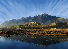
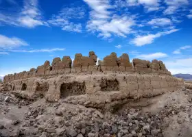
On the 94th day of the poor tour of China, the Pamir Plateau Pamir Plateau is Persian, meaning flat roof. The Han Dynasty of China was proportionate to the green onion, and the ancient Silk Road passed here. The Pamir Plateau spans southwest China's Xinjiang, southeast Tajikistan, and northeast Afghanistan. It is a huge mountain knot at the intersection of Kunlun, Karakoram, Hindu Kush and Tianshan Mountains. Most of the people who went to Pamirgao's original tours went to Tashkurgan Tajik Autonomous County (referred to as Ta County) in the northeast. There are Baisha Mountain Baisha Lake Scenic Area, Stone City Site, Mustag Peak (father of icebergs), Hongqilafu Port (China's only land port to Pakistan), there are also China-Pakistan border pillars 7 and spectacular national gates. Of course, there is also a very important place to check in. First sell a Guanzi ~ after entering the mountain, the first attraction is Baisha Mountain Baisha Lake. White sand mountain is also called "Xiangsha Mountain", the mountain is Brunkule Lake in front of the mountain, the mountain is ChaClark Lake, the water and grass are fat, the blue mountain is covered by white sand, half covered, and the snowy mountains on the top of the mountain and the lake under the mountain together, forming a group of beautiful pictures! Tashkurgan Stone City is one of the three most famous stone cities in the history of China. More than a thousand years ago, the people of the country of Selekur built it in 120 days. There has been prosperity and war. It stands on a large rock, at the foot of the Aral grassy beach, where the Tashkurgan River runs by. More than a thousand years ago, the Tajiks had no advanced tools, but they completed the grand and magnificent project of the Stone City in a very short time. Yesterday I had gone to the port of Ilktan, and this time I did not go to the port of Hongqila. 1. The beautiful snowy mountains on the Pamir Plateau 2. Entered the mountain 3. Baisha Mountain and Baisha Lake, at an altitude of 3663 meters 4. Baisha Mountain and Baisha Lake Group Figure 5. Stone City, about 3,000 meters above sea level 6. Stone City Inner City Site 7. Stone City Group Figure 8. Aral Cao Beach, also known as Jincao Beach 9. Modern people built with stones in the scenic area Living, living people!
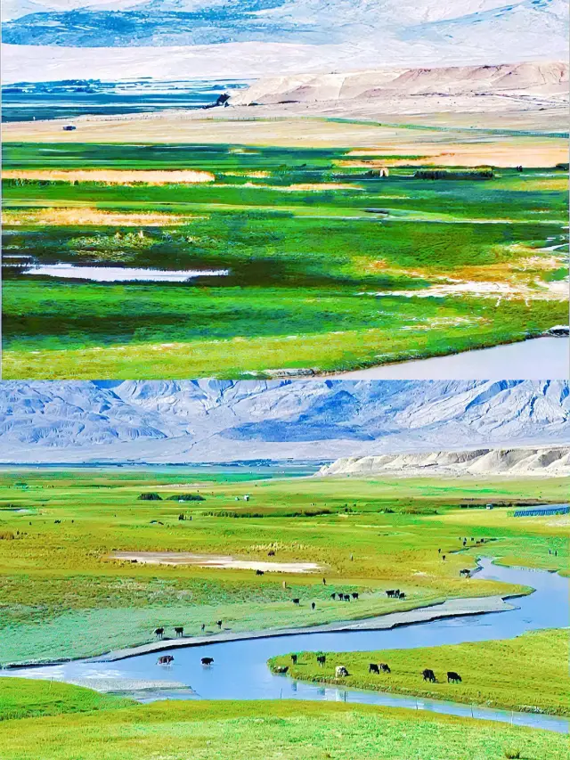
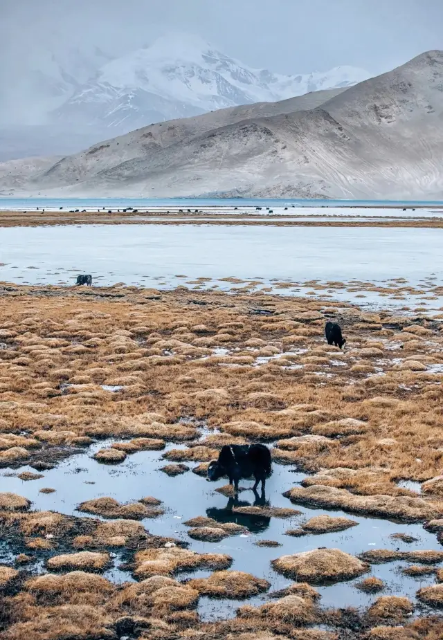
When I first entered the Pamir Plateau, I felt the yellow sand, all over the Gobi, desert and desert beaches, desert and desolate. But after slowly entering, it was found that the ecological environment on the Pamir Plateau was extremely rich, and various plants and animals were also rich in variety, and even videos of eagles flying soaring. The snow-capped mountains melted water throughout the year, pouring out a large area of natural pastures, cattle and horses, especially herds of yaks, were strong and fruitful. The green grass, the middle pond was covered with microwaves, reflecting the blue sky, white clouds, and snow-capped mountains, which were like dreams.