OverviewBookNearbyReviewsWin PrizesRecommended
Share to
Duku Highway
獨庫公路6.7
1169 Reviews
Closed Reopens 10:00, June 1
Recommended sightseeing time:0.5-1 day
Address:
217 National Rd, Nileke Xian, Yili Hasakezizhizhou, Xinjiang Weiwuerzizhiqu, ChinaMap
What travelers say:
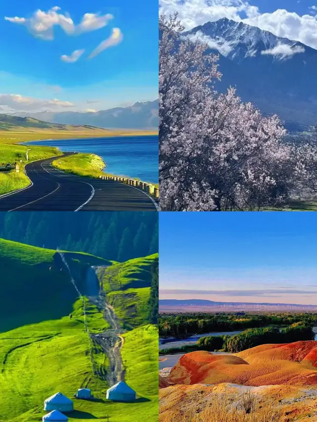
Duku Highway, the landscape avenue that runs through the ridges of the Tianshan Mountains, is known as the domestic self-driving ceiling, which almost concentrates all the beauty of Xinjiang. On this road, you can see rich natural landscapes such as Gobi, desert, canyons, grasslands, snow-capped mountains, lakes, etc., and different scenery is ten miles a day through four seasons. More than 560 kilometers away, experience different driving fun, feel an unforgettable journey.
More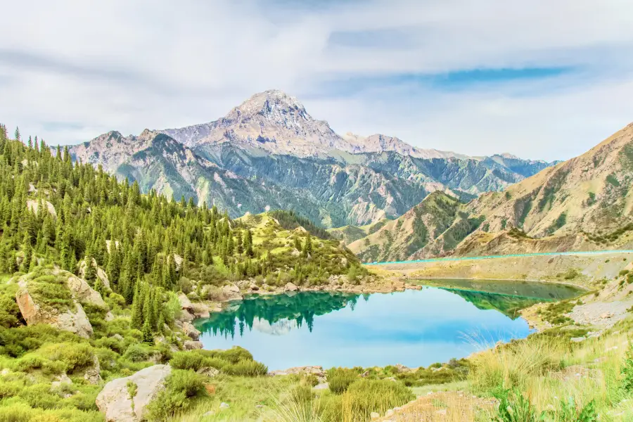
See all 109 photos
Saved by 29
Duku Highway Highlights: Must-See Features and Attractions
Some information may have been translated by Google Translate
The Duku Highway is about 561 kilometers long, connecting the northern and southern Xinjiang, spanning lofty mountains, crossing deep mountains and canyons, and connecting many ethnic minority areas. Its connection has shortened the distance between northern and southern Xinjiang by nearly half from the original 1,000 kilometers, which can be regarded as a monument in the history of China's highway construction. One-fifth of the Duku Highway is in the permafrost layer of high mountains, and one-third is a cliff. It spans nearly ten major rivers in the Tianshan Mountains, and climbs four snow-capped mountains that are covered with snow all year round. It is extremely difficult to drive. The scenery along the way here can only be described as magical. From the ancient Qiuci Kingdom to the northeast along the National Highway 217, the Duku Highway begins to peel off its mystery layer by layer. Along the way, you can enjoy the fairy lake in Tangbula, the fiery Kizilia mountain landscape, the steep canyon scenery, the lush Tianshan Mountains, the vast grasslands and the beautiful nomadic style.
Recommendations Near Duku Highway
Duku Highway Reviews: Insider Insights and Visitor Experiences
Some reviews may have been translated by Google TranslateWrite a Review
/5
Outstanding ReviewsAll (1,169)
Latest
With Photos (1,011)
Positive Reviews (284)
Negative Reviews (2)
- 1
- 2
- 3
- 4
- 100
Duku Highway Photos: Trip Moments
 I stayed in Xinjiang for a month to tell you some things not to doDon't ask how much the ticket is, ask how many years of youth are left. I decided to embark on a journey to Xinjiang in the northwest of my motherland, using a month to find my lost soul. After coming back, I am full of motivation, often staring at the photos in a daze. To help friends who want to go to Xinjiang, I have compiled this travel guide, hoping to help everyone! Where should I go first when I go to Xinjiang for the first time? Urumqi, as the transportation hub of Xinjiang, is very convenient whether it is South Xinjiang or North Xinjiang. It is recommended to choose Urumqi as the first stop, because whether it is a group tour or self-driving, almost all vehicles start from here. Precautions: Time difference: There is a 2-hour time difference between Xinjiang and the mainland Many ethnic minorities are used to saying Xinjiang time Security check: Xinjiang's security check is very strict, train stations and airports require multiple security checks, it is recommended to go to the train station/airport in advance Accommodation recommendation: Urumqi: Recommend Friendly Business Circle or Zhongshan Road Business Circle Kanas: Recommend Beitun City, secondly, Jadunyu and Burqin can be recommended Hemu: Recommend staying in the scenic area log cabin, watching the stars all over the sky at night, increasing the play time during the day, and the experience is better Sailimu Lake: Accommodation is recommended to stay in Qingshuihe Town or Huocheng County Our self-driving route: Starting from Urumqi, go to Sailimu Lake—Huocheng—Zhaosu—Tekes—Qiongkushitai—Nalati—Duku Highway, and finally return to Urumqi from Dushanzi. The route is just a circle, which is a classic Yili ring line. ps: The above self-driving journey is 12 days in total, a total of 2300 kilometers, without rushing to the road and rushing to the scenic spots, often 5-6 hours of self-driving time every day. I feel that rest and maintaining a good state are necessary. Must-visit attractions: Qiongkushitai: The grassland covering the sky, the fairy tale forest like a mist, the small wooden house with grass on the head, every eye is super healing Huocheng Lavender: The purple sea of flowers tumbling with the wind is really romantic Tangbula Fairy Lake: A small popular secret that needs to ride a horse up the mountain, accompanied by flowers all the way, it seems to be Alice in Wonderland Nalati Grassland: The aerial photography and self-driving of the grassland and valley in the sky are absolutely amazing! Sailimu Lake: "The last tear of the Atlantic" If you have plenty of time, you must go for a self-driving tour around the lake Duku Highway: Duku Highway that must be self-driving once in a lifetime! It will open around mid-June every year, and you will feel the four seasons along the way. Xinjiang cuisine: The big plate chicken, lamb skewers, roasted lamb chops, and roasted buns in Xinjiang are really amazing, and those who like heavy tastes can close their eyes. ps: There are also old yogurt, cold water fish, hand-grabbed rice, wrapped meat, pulled strips and other delicacies waiting for you to taste!TheodoreLivingston2052
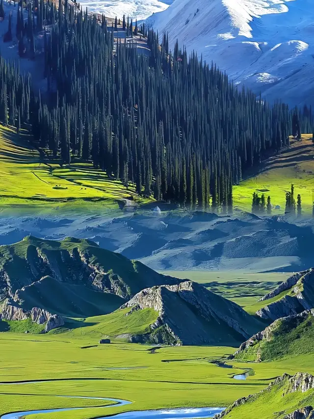
 12-Day Solo Travel Guide to Northern Xinjiang's Duku HighwayWhere to go for the holiday? It must be Xinjiang. With snow-capped mountains, lakes, forests, grasslands, and more, the scenery is truly diverse. Especially in summer, the grasslands and snow mountains appear in the same frame, resembling scenes from an animated world. Itinerary D1: From all over the country to Urumqi D2: Urumqi → Heavenly Lake of Tianshan → Fuyun D3: Fuyun → Keketuohai → Burqin D4: Burqin → Kanas Lake → Jiadengyu D5: Jiadengyu → Roaming Hemu → Stay in Hemu D6: Hemu → Wuerhe D7: Wuerhe → Devil City → Jinghe D8: Jinghe → Sailimu Lake - Sailing Experience → Kaxgar → Yining D9: Yining → Qiongkushitai → Xinyuan D10: Xinyuan → Nalati Air Grassland → Nalati Town D11: Nalati → Duku Highway → Martyrs' Cemetery D12: Return flight from Urumqi 【tips】 1. Some areas in Xinjiang have poor signal, it is recommended to carry cash 2. There is a large temperature difference between morning and evening in Xinjiang, it is advisable to bring a coat 3. Some areas in Xinjiang are dry, be sure to drink plenty of water to avoid bleeding from dryness. 4. In Xinjiang, goods are sold by the kilogramHATTIE NORMAN1
 Yili Luxury 5-Day TourXinjiang is the right way to cool off in summer. Summer is not just about air conditioning and watermelon, Come out and see the blue sky, white clouds, green pastures, and snow-white mountains Winding rivers, purple sea of flowers Come to Xinjiang to start a summer of 20°C .Get up and take a look at the stunning itinerary starting from Yining Day1: Yining City - Guozigou Bridge - Sayram Lake - Jinghe Day2: Jinghe - Dushanzi Grand Canyon - Duku Highway - Narat Day3: Narat Grassland - Qiaxi - Tekes Day4: Tekes - Qiongkushitai - Zhaosu Day5: Zhaosu - Xiat - YiningSLOAN MORAN
 Ili + South Xinjiang Essence 16-day Tour Guide【Opening】: South Xinjiang, Once the thirty-six countries of the Western Regions, the bustling Silk Road. Emperor Wu of Han defeated the Huns here, Xuanzang returned eastward from his pilgrimage here, and the Tang Monk and his disciples passed through here on their journey to the West. It is the dreamy Western Regions that haunt people's dreams, and the ultimate dream of countless travelers. ⛺【Play Tips】: Bai Sha Lake---The blue crystal on the Pamir Plateau Duku Highway---The most beautiful highway that must be traveled in this life Da Xiao Long Pool---Two green gems embedded next to Duku Kizil Thousand Buddha Caves---The murals in the grottoes in the vast desert, meeting the ancient country of Kucha Kashgar Old City---"Gao Tai residential buildings" century-old tea house, a very charming small city Panlong Ancient Road---Walk all the winding roads in one day, and all the roads ahead are smooth Karakul Lake---The holy lake under the snow mountain, the pearl on the Pamir Plateau 🛬【Itinerary】: Day 1 All over the country--Urumqi Day 2 Urumqi--Sailimu Lake Day 3 Sailimu Lake--Lavender Base--Kazanqi Folk Culture Village--Yining Day 4 Yining-Izhao Highway Shate Ancient Road--Zhaosu Day 5 Zhaosu--Qiongkushitai--Tekes Day 6 Tekes-Kalajun Grassland-Kuokesu Grand Canyon--Xinyuan Day 7 Xinyuan--Nalati Grassland--Bayinbuluke Day 8 Bayinbuluke-Duku Highway-Da Xiao Long Pool-Tianshan Mysterious Grand Canyon-Kuche Day 9 Kuche-Tahe Bund-Tarim River Bridge-Shaya Devil Forest-Alar Day 10 Alar--Desert Highway--Yotkan Ancient City-Hotan Day 11 Hotan--Shache Mansion-Yeerqiang Khan Mausoleum--Kashgar Day 12 Kashgar Old City Aitigar Mosque Century-old Tea House Day 13 Kashgar Baisha Mountain-Baisha Lake--Karakul Lake--Tashkurgan Day 14 Tashkurgan-Panlong Ancient Road-Bandier Lake-Jincao Beach Stone City-Tashkurgan Day 15 Tashkurgan--Oytag Red Mountain--Oytag Glacier Park--Kashgar Day 16 Kashgar--All over the country 🧡【tips】: 1. Apply for the border defense certificate in advance, either in the place of household registration or in Kashgar 2. Bring thick clothes for the plateau's four seasons in one day 3. Sunscreen/hat/sunglasses/rehydration are essentialShirley Cronin
 A 12-day leisure vacation in Northern Xinjiang, featuring grasslands, deserts, and lakesIn Northern Xinjiang, there are heavenly sights such as Kanas Lake, the idyllic Hemu Village, Sayram Lake on the grassland, the colorful Beach of Five Colors, and the forbidden land of Wuerhe. DAY1: Urumqi~Desert Highway~Ulungur Lake~Burqin DAY2: Burqin~Hemu~Hemu Village DAY3: Hemu Village~Kanas Three Bays~Kanas Lake~Jiadengyu DAY4: Jiadengyu~Beach of Five Colors~Burqin DAY5: Burqin~Devil City~Kuitun DAY6: Kuitun~Sayram Lake~Qingshui River DAY7: Qingshui River~Qiongkushitai~Tekes Bagua City DAY8: Tekes~Hundred-Mile Gallery~Fairy Lake~Qiaojia Manalati Town DAY9: Narat~Narat Scenic Area~Duku Highway~Bayanbulak Nine Curves Eighteen Bends DAY10: Bayanbulak~Duku Highway~Tianshan Mysterious Grand Canyon~Korla DAY11: Korla~Flaming Mountains~Kumtag Desert~Bishan DAY12: Shanshan~Karez Wells~Turpan Grape Valley~Urumqinysara_2839
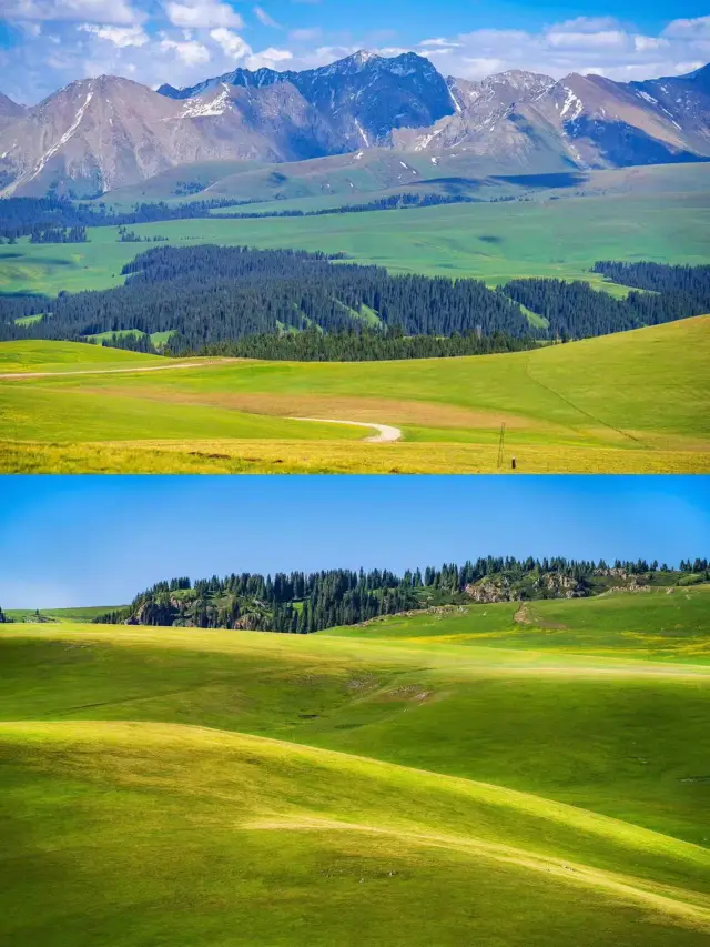
 7-Day Essence Tour of Northern XinjiangSayram Lake is the highest-altitude, largest, and most scenic alpine lake in Xinjiang. It is also the last place cherished by the warm and humid Atlantic air currents, hence the saying that it is 'the last tear of the Atlantic'. The summer season is the perfect time to visit Sayram Lake, and for friends who want to play at Sayram Lake, this travel guide is highly recommended. Like and save it, and you'll definitely not get lost! 🌺Recommended Itinerary: 🎉A: 7-Day Grand Northern Xinjiang Loop 🎄D1: Urumqi - Colorful Beach - Burqin 🎄D2: Burqin - Kanas 🎄D3: Jiadengyu - Hemu 🎄D4: Hemu - Urho Ghost City - Urho 🎄D5: Urho - Sayram Lake - Yining/Qingshui River 🎄D6: Yining/Qingshui River - Nalati - Bayanbulak 🎄D7: Bayanbulak - Duku Highway - Urumqi 🎉B: 8-Day Grand Northern Xinjiang Loop 🎄D1: Urumqi - Tianshan Tianchi - Fuyun/Koktokay. 🎄D2: Fuyun/Koktokay - Koktokay - Colorful Beach - Burqin 🎄D3: Burqin - Kanas - Jiadengyu 🎄D4: Jiadengyu - Hemu 🎄D5: Hemu - Ghost City - Urho 🎄D6: Urho - Sayram Lake - Yining 🎄D7: Yining - Nalati Grassland in the Sky - Bayanbulak 🎄D8: Bayanbulak - Duku Highway - UrumqiKennedi Braun IV1
 Xinjiang Panoramic North Xinjiang Pure Play 15-Day Tour GuideSpring is in the air, and beautiful Xinjiang is also welcoming the splendid apricot blossoms. The endless grasslands are sprouting new buds, turning into a lush green. The little wildflowers on the prairies are also slowly blooming, and nature's gifts are always the most beautiful. North Xinjiang 15-day itinerary 🔻D1: Urumqi - Heavenly Lake of Tianshan - Stay in Fuyun 🔻D2: Fuyun - Keketuohai - Colorful Beach (Sunset) - Stay in Burqin 🔻D3: Burqin - Kanas Three Bays (Fairy Bay, Moon Bay, Crouching Dragon Bay) - Stay in Kanas Scenic Area Log Cabin 🔻D4: Kanas Lake - Guanyu Pavilion - Baihaba - Stay in Baihaba Scenic Area Log Cabin 🔻D5: Kanas - Hemu River - Hemu Bridge - Hemu Starry Sky - Stay in Hemu Scenic Area Log Cabin 🔻D6: Hemu Morning Mist Sunrise - Beautiful Peak - Hemu Birch Forest - Stay in Burqin 🔻D7: Burqin - World Devil City (Yadan Landform) - Stay in Kuitun City 🔻D8: Kuitun City - Sayram Lake Scenic Area - Stay at Sayram Lake - Yining 🔻D9: Yining - Qiongkushitai - Tekes 🔻D10: Tekes - Nalati Air Valley Grassland - Stay in Nalati 🔻D11: Nalati - Midsection of Duku Highway - Bayanbulak - Nine Curves Eighteen Bends - Swan Lake - Stay in Bayan 🔻D12: Nalati - Northern Section of Duku Highway - Qiaojia - Tangbula Fairy Lake - Dushanzi 🔻D13: Dushanzi - Dushanzi Grand Canyon - S101 National Defense Highway - Urumqi 🔻D14: Urumqi - Jiaohe Ancient City - Karez Wells - Flaming Mountains - Kumtag Desert - Dushanzi 🔻D15: Dushanzi - Tuyugou Valley Mazha Village - Stay in UrumqiElijah.Peterson.68
 10-Day Panoramic Tour Guide for Yili Ring Road【Opening】: The correct way to spend summer in Xinjiang Summer is not just about air conditioning and watermelon, Come out and see the blue sky, white clouds Green pastures, snow-capped mountains Winding rivers, purple flower sea Come to Xinjiang to start a 20°C summer ⛺【Play Tips】: Qiongkushitai Mysterious and low-key, you can experience the original ecological herdsman life Xia Ta It's a small popular secret, not yet deliberately developed, no commercial atmosphere, beautiful to the heart Tekes Climb the sightseeing tower in the city, the whole city is a large Bagua array, there is no traffic light in the city, every road is passable, really magical Dushanzi Grand Canyon Has 'Duku Secret, Billion Year Wonder', the terrain features are like on the moon's surface. Tangbula Fairy Lake It is also an underestimated small popular beauty, hidden in the mountains of the beautiful quiet small lake, and blue sky, white clouds, green mountains and green water, flowers and grass set off like a paradise. 🛬【Itinerary】: D1: Urumqi - Pick up D2: Urumqi - S101 Highway - Dushanzi Grand Canyon - Kuitun D3: Kuitun - Sailimu Lake - Guozigou - Yining D4: Yining - Tianma Bath River - Zhaosu Yuhu - Zhaosu D5: Zhaosu - Xia Ta Ancient Road - Tekes D6: Tekes - Qiongkushitai - Gongliu D7: Gongliu - Chaxi - Kuerdening - Narati D8: Narati - Bayinbuluke - Tangbula D9: Tangbula - Fairy Lake - North Section of Duku Highway - Dushanzi Grand Canyon - Urumqi D10: Urumqi - Send off 🧡【tips】: The ultraviolet rays in Xinjiang are really strong, and the wind is strong, be sure to prepare for sun protection. When looking for hotel accommodation, be sure to compare prices on multiple platforms, book hotels in advance during summer or holidays, otherwise they are full. Be sure to make a good travel guide before traveling to Xinjiang, plan in advance whether to join a group or charter a car or self-drive. Prepare some cash in advance, some scenic spots or mountain areas have poor signal.Logan Montgomery
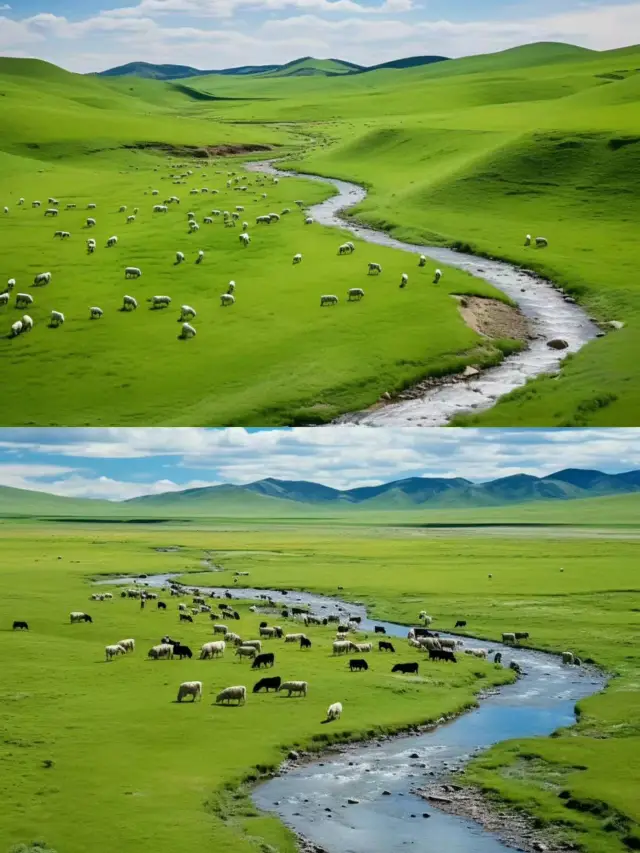
 This road, stringing together the miracles of the four seasons, is Xinjiang's Duku Highway🌟 Imagine a road that strings together the miracles of the four seasons, this is Xinjiang's Duku Highway, a dream paradise for self-drivers! 🚗✨ As a dazzling pearl among China's top ten self-driving routes, the Duku Highway is not just a road; it is an ode to heroes, an eternal tribute to the 168 souls who built it 🌹. A magnificent scroll 562 kilometers long, laid out over ten years, each inch a testament to nature and courage. 🔥 Northern section: From Dushanzi to Nalati, 215 kilometers of continuous surprises! From the awe-inspiring start at the Dushanzi Grand Canyon, to the three-thousand-feet drop of the Heavenly Waterfall, to the silent tribute at the Qiaolma Martyrs' Cemetery, and finally, getting lost in the endless greenery of Tangbula and the Nalati Grassland. 🏞️ Fill up the tank, bring your mood, and set off! ⛽ 🌄 Middle section: Short but exquisite, 65 kilometers between Nalati and Bayinbuluke, as if crossing the boundary between two worlds. Endless grasslands under the blue sky, flocks of cattle and sheep, a beauty that refreshes the soul. 🐑 🌌 Southern section: From Bayinbuluke to Kuqa, a 270-kilometer journey, a feast of colors and landforms. The Dragon Pools, large and small, are like emeralds inlaid, and the Kuqa Grand Canyon holds the secrets of the Earth. Don't forget, at the small toll station at the southern end, just 20 yuan buys you a ticket to the wonders. 💰 ⏰ Important reminder! The Duku Highway is not a secret garden open all year round~ Approximately from June to mid-October, it opens at sunrise and closes at sunset, with entry but no exit, all depending on the weather, so remember to follow the official news from Dushanzi Traffic. ☀️💨 🚘 Vehicle tips: Exclusively for small cars, the moment to test your driving skills has arrived! Sharp turns, steep slopes, the dance of two-way traffic, safety first, hold steady, we can win! 👀 🚗 Pre-departure ritual: Full vehicle check, full gas tank, plenty of snacks and drinks, just in case. 🥤 📸 Photography tips: With beautiful scenery ahead, please park civilly, watch out for falling rocks and cliffs, and don't let your selfie turn into a live broadcast of danger. 📸 🌈 Lastly, the weather on the Duku Highway changes faster than a child's face, don't panic if you encounter traffic control, the traffic police are always online to protect your journey. 🚨Olivia Baker
 Northern Xinjiang's Duku Highway 10-Day Tour of Double Lakes + Double GrasslandsDuku Highway: It is the southern section of National Highway 217 that connects the north and south of Xinjiang, also known as the Tianshan Highway. Sayram Lake: It is the last place in Xinjiang where the warm and humid air currents of the Atlantic Ocean linger, known as 'the last teardrop of the Atlantic'. Naraty: It integrates grasslands, valleys, and forests, with a high vegetation coverage and rich wildlife resources. 10-Day Itinerary in Northern Xinjiang along the Duku Highway: D1 Home - Urumqi D2 Urumqi - Tianshan Tianchi - S21 Gurbantunggut Desert - Pass by Wulungu Lake - Burqin Night Market D3 Burqin - Kanas - Wolong Bay - Moon Bay - Fairy Bay - Jiadengyu D4 Jiadengyu - Hemu Tuwa Village - Hemu Viewing Platform - Hemu D5 Hemu - Wuerhe Devil City - Karamay D6 Karamay - Sayram Lake - Guozigou Bridge - Lavender Farm - Yining City D7 Yining City - Kazanqi Six-Star Street - Qaxi National Forest Park - Naraty Town D8 Naraty - Naraty Sky Grassland - Xinyuan D9 Xinyuan - Tangbula Hundred Mile Gallery - Jor Madan Pass - Duku Highway - Urumqi D10 Urumqi - HomeJEFFREY RODGERS2
 Xinjiang Southern Region Tourism | 8-Day Pure Play Travel GuideThe 8-day pure play travel guide. The combination of culture and natural scenery in Southern Xinjiang can be described as perfect. Visiting Kashgar allows you to experience the local customs of Xinjiang and see different beautiful landscapes, with the core being the Pamir Plateau. The main features are not flora, but the vast and magnificent snow mountains, lakes, rivers, and landforms... Suggested Itinerary: D1: Departure place - Urumqi D2: Urumqi - en route Wind Power Station - passing by Xinjiang Salt Lake Scenic Area - Korla D3: Korla - Loulan Village - Resitan Street - Kuqa D4: Kuqa - Flaming Spring - Xinjiang Tianshan Tumor Scenic Area·Grand Canyon - Aksu D5: Aksu - Kashgar Old Town - Kashgar D6: Kashgar - White Sand Lake - Muztagh Glacier Park - Golden Beach - Stone City - Taxkorgan D7: Taxkorgan - Panlong Ancient Path - Bandier Lake - Muztagh Peak - Karakul Lake Scenic Area - Kashgar D8: Kashgar - Warm Home Travel Tips: 🔸There is a big temperature difference between morning and evening, so bring seasonal clothes as well as some thick clothes 🔸When going to the Pamir Plateau, be prepared for wind protection and warmth, especially since the Panlong Ancient Path can be quite windy and sandy 🔸Panlong Ancient Path might cause motion sickness, so it's advisable to prepare some motion sickness medicine 🔸The altitude of the Pamir Plateau is high, be aware of altitude sickness and avoid strenuous exercise3ll@ Sc0tt
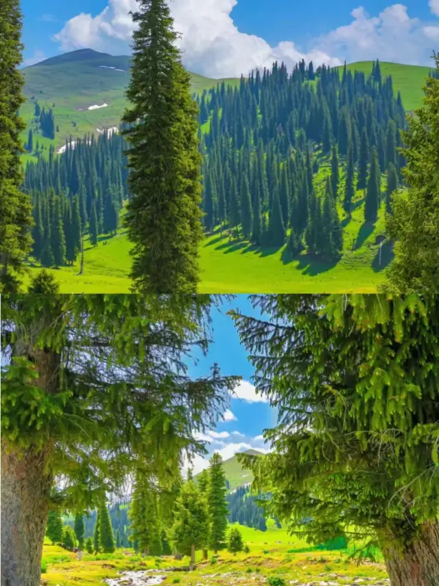
 I stayed up all night to organize the 2024 Duku Highway travel guide, the super detailed kind🌈 Duku Highway, also known as National Highway 217 from Dushanzi to Kuqa, connects southern and northern Xinjiang, traverses the Tianshan Mountains, and is also known as the Tianshan Highway. The entire journey is 561 kilometers long and requires crossing over 4 mountain passes. Here, you can experience all four seasons in one day, and every ten miles offers a different sky. The scenery is primitive and stunning! It has been selected by 'National Geographic' as a 'scenic avenue that traverses the spine of the Tianshan Mountains,' especially the southern section's Big and Small Dragon Pools, which are like two crystal-clear gems, delighting the heart and refreshing the mind! The canyon's landforms are like stepping into a magical and different world, mysterious and shocking! 💥Must-visit attractions ✅Tianshan Mysterious Grand Canyon: A bright pearl on the ancient Silk Road! It combines the beauty of earthly canyons and the uniqueness of Tianshan's scenery, embodying the spirit of eternity, and integrating the divine, the strange, the dangerous, the majestic, the ancient, and the secluded into one, like a magical different world. ✅Naraty Grassland: One of the top ten scenic areas in Xinjiang and also one of the four great grasslands in the world. It encompasses snow-capped mountains, grasslands, valleys, and forests, with a high vegetation coverage rate and rich wildlife resources. Its 'sky grassland' is the most classic. ✅Qiaojia Hero Monument: A red base, the Heroic Tianshan Road was built to commemorate the 168 revolutionary martyrs who sacrificed themselves for the construction of the Duku Highway and is a national revolutionary martyrs' cemetery. ✅Bayinbuluke: China's second-largest grassland, with lush water and grass, was a filming location for the movie 'Pegasus'. Not only does it have the 'Nine Curves and Eighteen Bends' of the Kaidu River, but also the elegant and charming Swan Lake. With luck, you can see swans. When you stand on the mountaintop by Swan Lake at sunset, and the sun shoots thousands of rays of light through the clouds onto the grassland, you can see the winding Kaidu River reflecting the nine suns shot down by Hou Yi, which is very magical. ✅Tangbula Grassland: A natural scenic area that combines forests, grasslands, rapids, and mountainous beauty, and was a filming location for 'Flowers of the Tianshan'. Its Fairy Lake is a popular internet spot, and the ancient Mengketu Trail to the north is also worth a visit. ✅Dushanzi Grand Canyon: Known as the 'Duku secret realm, a billion-year spectacle,' it has been featured in National Geographic as the most beautiful highway in the country and is the number one scenic spot on the Duku Highway. It was also a filming location for the TV series 'Novoland: The Castle in the Sky' and the movie 'Pegasus'. 🔴‼️To fully experience the beauty of Duku, cycling is the best strategy D1 Departure point - Dushanzi Town, warm-up cycling for 5 kilometers D2 Dushanzi Town - Wulansadak (Silk Road Station 639), cycling for 85 kilometers D3 Wulansadak - Hashilegendaban - Hundred Mile Gallery - Qiaojia, cycling for 86 kilometers D4 Qiaojia - Hundred Mile Gallery - Naraty, distance 117 kilometers, cycling for 87 kilometers D5 Naraty - Lartundaban - Bayinbuluke, cycling for 69 kilometers D6 Bayinbuluke - Big and Small Dragon Pools - Kuruli, cycling for 156 kilometers D7 Kuruli - Tianshan Grand Canyon - Kuqa, distance 105 kilometers, cycling for 87 kilometers ⚠️Tips 1️⃣ The Duku Highway is only open for about four months a year (June to September), but it will be closed in extreme weather. The road condition is good, and only vehicles with 7 seats or less are allowed to pass. 2️⃣ Accommodations at the starting and ending points are very good. Midway accommodations are in Naraty and Bayinbuluke. If you don't watch the sunrise at the 'Nine Curves and Eighteen Bends', Naraty is preferred. 3️⃣ There are 4 mountain passes in total, with many sharp turns. Remember not to overtake, overtake in the wrong direction, or coast downhill in neutral. 4️⃣ Some places have no signal. Inform family and friends in advance if there's an issue, and also carry some change and snacks in case of unexpected traffic jams. 5️⃣ During peak season, traffic jams from north to south on Duku are severe. If you only travel on Duku, it is recommended to start from Kuqa in the opposite direction. 6️⃣ Do not stop to take photos at random, pay attention to safety, and there are special parking areas along the way for viewing and taking photos; if you encounter thin ice, water stains, cattle, and sheep, please observe the road surface and drive slowly. 7️⃣ The Duku Highway has 'four seasons in one day,' even in summer, you need to bring cold-weather clothing. 8️⃣ The essence of the Duku Highway is in the southern section, from Bayinbuluke to Kuqa. Travel agencies generally won't go out of their way to visit, but if you have plenty of time and are self-driving/chartered, be sure to complete this section. 9️⃣ The toll station on the Duku Highway is located more than 10 kilometers away from Kuqa City at Yanshui Gully 20, and it charges both ways. 🔟 There are very few gas stations along the way (as shown in the picture), and there will be queues! Be sure to fill up when you encounter a gas station. 1️⃣1️⃣ There are three charging stations along the way: Maoliu Gully Service Area, Lati Tourism Service Area, and Bayinbuluke Pegasus Bayin Self-Driving Camp. 1️⃣2️⃣ Most of the road sections have a speed limit of 40, some cannot exceed 30, and the maximum speed cannot exceed 80. 1️⃣3️⃣ Traffic hours: 7 am to 9 pmsilas_winterbourne_88
- 1
- 2
- 3
- 4
Nearby Attractions
百里畫廊 | Shidiguyang Sceneic Area | Gongnaisi River | 喀什河 | 特斯克塔斯 | Nilka Library | Nulasai Copper Mine Ruins | 尼勒克縣文化中心 | 益友中老年活動中心 | Lamatuo Main Channel | Friendship Square | Beidaqu | Akeqi Canal | Huji'ertai Canal | Nileke River | Suozimu Tesayi | Kezi Letuo Main Channel | Qiaqihe | Bieletuo Main Channel | Wulasitai Canal | Kala Sugou | Tie'er Situogan | 包尕斯達阪 | 古楊樹 | 觀景台 | 吉晟寺 | 喀什河 | 吉林台親水旅遊區 | 觀景長廊 | 四季花海
Popular Types of Attractions in Nilka County
Nature | Grasslands | Mountains | Lakes | Architecture & Landmarks | Featured Neighborhoods | Squares | landmark | Lifestyle | Libraries | Resorts | Campgrounds | Exhibition Centers | Museums | Exhibition Halls | Memorial Halls | Parks | City Parks | Botanical Gardens | Water Parks | Traditional/Cultural Experiences | Villages | Farms | Historic Sites | Historical Sites | Ancient Towns | Sports | Religious Sites | Outdoor Sports
Popular Restaurants in Nilka County
原始羊肉抓饭 | 昂洒农家院 | 回宴楼 | 乔尔玛星空营地餐厅 | 佳湘小厨馆 | 乔尔玛儿子娃娃特色蘑菇饭庄 | 伊犁金牌拌面王 | 伊力亚斯快餐厅 | 巴蜀人家(健康路店) | 五月的沙枣花抓饭(尼勒克店) | 马成军牛肉面馆 | 老牌子原味野蘑菇拌面王 | XING MEI SHI CHENG | 萨巴拌面王 | 久点冰激凌休闲吧 | 楼兰幽香 | 渝湘食府 | 特色野蘑菇拌面抓饭王 | 山女湖木楼避暑山庄 | 孟氏小厨 | 金鲨宾馆饭店 | 祖克兰快餐 | 炭之家大片烤肉 | 望湘园餐厅 | 儿子娃娃特色拌面 | 辣风芹米粉店 | 蜜雪冰城(唐布拉街店) | 唐布拉回民风味饭庄 | 三里香牛肉面馆 | 乔尔玛特色野蘑菇拌面快餐馆
Popular Destinations
Nottingham Travel | Faro Travel | Prague Travel | Zhangjiajie Travel | Hersonissos Travel | Shenzhen Travel | Orlando Travel | Guilin Travel | Dubrovnik Travel | Maldives Travel | Zakinthos Island Travel | Busan Travel | Tivat Travel | Ho Chi Minh City Travel | Bremen Travel | Skegness Travel | Bengaluru Travel | Cairns Travel | San Diego Travel | Boothbay Travel | San Mateo County Travel | Quernmore Travel | Glossop Travel | Klamath County Travel | Kronshtadt Travel | Mae Fa Luang Travel | County Mayo Travel | San Miguel County Travel | Olympia Travel
Recommended Attractions at Popular Destinations
Bangkok attraction near me | Manila attraction near me | Tokyo attraction near me | Hong Kong attraction near me | Seoul attraction near me | Taipei attraction near me | Los Angeles attraction near me | New York attraction near me | Shanghai attraction near me | Kuala Lumpur attraction near me | Shenzhen attraction near me | Osaka attraction near me | London attraction near me | Singapore attraction near me | Guangzhou attraction near me | San Francisco attraction near me | Beijing attraction near me | Macau attraction near me | Bali attraction near me | Paris attraction near me | Orlando attraction near me | Jakarta attraction near me | Ho Chi Minh City attraction near me | Chicago attraction near me | Phuket attraction near me | Toronto attraction near me | Istanbul attraction near me | Cebu attraction near me | Seattle attraction near me | Dallas attraction near me
Popular Ranked Lists
Popular Family-friendly Attractions Near Majiang | Popular Family-friendly Attractions Near Juancheng | Popular Family-friendly Attractions Near Huinan | Popular Luxury Hotels Near Ankara | Popular Fine Dining in Macau | Popular Premium Hotels Near San Ignacio | Top 7 Bars in Zhongshan | Top 4 Bars in Ningde | Popular Family-friendly Attractions Near Guidong | Popular Luxury Hotels Near Haridwar | Popular Family-friendly Attractions Near Xixia | Top 11 Local Restaurants in Vientiane | Top 11 Fine Dining in Istanbul | Popular Luxury Hotels Near Cikokol | Top 5 Bars in Weifang | Top 7 Bars in Dusseldorf | Popular Luxury Hotels Near Bang Muang | Popular Family-friendly Attractions Near Yakeshi | Popular Luxury Hotels Near Shangdu | Popular Family-friendly Attractions Near Daming | Popular Family-friendly Attractions Near Jianchang | Popular Luxury Hotels Near Sivas Merkez | Popular Premium Hotels Near Ilocos Norte | Popular Luxury Hotels Near Coogee | Popular Family-friendly Attractions Near Yuhuan | Popular Family-friendly Attractions Near Jize | Popular Luxury Hotels Near San Vicente | Top 12 Fine Dining in Changsha | Popular Premium Hotels Near Bethlehem
More Things To Do in Nilka County
China eSIM Day Pass/data Package days selected without cards QR code | China·Hong Kong·Macau eSIM|Unlimited 4G High Speed Data | China Mainland eSIM|China Mobile Unlimited 4G High Speed Data | China, Hong Kong, and Macau eSIM|Total 5GB/10GB/15GB/20GB High-speed 4G LTE Unlimited high-speed data | [China Mainland] eSIM | SIM to China | 8GB 8days 4G high speed | Asia・Australia eSIM|AIS SIM2Fly 8 days 6GB High-speed Unlimited 5G/4G Data | Mainland China eSIM |China Mobile 4G high-speed unlimited data eSIM | Mainland China + Hong Kong + Macau eSIM 4G Data Daily Plan QR Code | Mainland China + Hong Kong + Macau eSIM Data Plan QR Code | eSender - Mainland China eSIM daily package/traffic package, days optional. No need to get the card QR code | eSIM for China, Hong Kong and Macau. Universal for Mainland China/Hong Kong/Macau. Optional days for travel and business. QR code | China/Hong Kong/Macau eSIM 4G high-speed network QR code | Trip.SIM Japan, South Korea, Macau, Taiwan and many places in Asia + Australia and New Zealand 4G travel data roaming phone network card 4 days/7 days | China, Hong Kong, Macau 4G SIM Card (HK, Macau, Taiwan, China Delivery Only) | Global multi-region A series eSIM|High-speed data, travel and business Internet access, optional unlimited data, optional days, QR code | China, Macau eSIM - Data plan by Gohub (QR Code) | [Mainland China] 4G Internet Card|China Unicom|Unlimited Data SIM Card|Number of Optional Days|Insert the card and use it|Self-pickup at Hong Kong Airport | Global multi-region B series eSIM|Universal in 54 countries Travel and business Internet access Optional unlimited data Optional days QR code | [FLASH SALE] China, Hong Kong, Macau eSIM - Data plan by Gohub (QR Code) | Mainland China eSIM high-speed network QR code | eSIM I series in multiple regions around the world | High-speed Traffic for tourism and business Internet access, unlimited Traffic, optional Days, QR code | Hong Kong eSIM local - Data plan by Gohub (QR Code) | China 4G SIM Card (HK, Macau, Taiwan, China Delivery Only) | Global (66 Countries) eSIM Data Package (QR Code) | AIS Asia esim data package (QR code) | AIS Global esim data package (QR code) | Asia 9 Regions eSIM 4G Data Daily Plan QR Code | dtac GO INTER eSIM|Asia, Australia, USA 10Days 6GB Unlimited Data | [Mainland China, Hong Kong and Macau] 4G Internet Card|China Unicom/Hutchison/CTM|Unlimited data SIM card|Number of optional days|Insert the card and use|Self-pickup at Hong Kong Airport | Global eSim for 140+ countries (sent via email) by Xplori
Payment Methods
Our Partners
Copyright © 2024 Trip.com Travel Singapore Pte. Ltd. All rights reserved
Site Operator: Trip.com Travel Singapore Pte. Ltd.
Site Operator: Trip.com Travel Singapore Pte. Ltd.
Duku Highway, the landscape avenue that runs through the ridges of the Tianshan Mountains, is known as the domestic self-driving ceiling, which almost concentrates all the beauty of Xinjiang. On this road, you can see rich natural landscapes such as Gobi, desert, canyons, grasslands, snow-capped mountains, lakes, etc., and different scenery is ten miles a day through four seasons. More than 560 kilometers away, experience different driving fun, feel an unforgettable journey.
Duku Highway, a skyline through the Tianshan Mountains, from Dushanzi in northern Xinjiang to Kuqa in southern Xinjiang. This national road is open for 4 months a year, and the whole journey can experience four seasons. It will be opened all the way through the mountains and mountains. It will be awestruck by the engineers who opened it. The more precipitous is the tiger mouth section located about 70 kilometers away from Dushanzi. It is pasted with the mountain and is surrounded by strong barbed wire. But the scenery along the way is also very beautiful, and it feels worth a walk in the rolling halfway up the mountain.
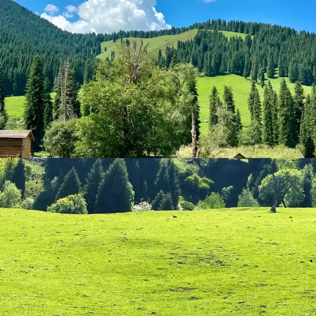
Duku Highway is a veritable landscape avenue, from the starting point of Dushanzi Grand Canyon, to the Nalati, Bayinbrook grassland along the way, and then to the end of the Kuqa Tianshan mysterious Grand Canyon. The most beautiful personal feeling is Baili Gallery to Bayin Grassland
20230720-0722 All day: 1. The "Duku Highway" is the "Kuqa-Dushanzi" section of 217 National Road, with a total length of 561 kilometers. It is the main traffic road of the north and south Xinjiang. The scenery along the way is beautiful, spanning a variety of landforms such as Gobi, hills, streams, wetlands, grasslands, snow-capped mountains, canyons and other landforms. It is known as the "most beautiful highway". It is a paradise for self-driving parties, the south is the desolate and rough Gobi mountain, and the north is the vibrant grassland valley. At least half of the highway is above 2,000 meters above sea level, and the highest altitude is more than 3,400 meters. It is generally closed from early November to May and June of the next year due to weather. ① Address: Kuche City, Aksu District, Xinjiang Uygur Autonomous Region, to Dushanzi District, Karamay City. ② Transportation: No bus access. ③ peak season: no. ④ Time: 2-4 Days. 2. Duku Highway began in 1964 with the approval of the central project 07042 and 0603, in 1969 officially construction, to 1979 the whole line opened to traffic, due to the difficult project, natural conditions, the construction process of 168 PLA soldiers gave their lives. Duku Highway is a monument in the history of China's highway construction, and its significance is that: ① greatly improve transportation efficiency: shorten the original journey of more than 1,000 kilometers from the north and south Xinjiang by half, saving time, effort and money. ② Promote Xinjiang's economic development: If you want to build roads first, it is convenient for Xinjiang's cattle, sheep, fruits, resources and energy to integrate advantageous resources. ③ Strengthen territorial defense capabilities: Xinjiang is bordered by 8 countries, and its geographical location is important and its national defense is of great significance. ④ Promote north-south exchanges in Xinjiang: Xinjiang accounts for 1/6 of the country's territory, and the north and south Xinjiang are blocked by Tianshan, and most residents of the two Xinjiangs have never visited another area in their lifetime. ⑤ Accumulation of construction experience: 1950s coincided with the deterioration of China-Soviet relations. After losing assistance, China's infrastructure construction began from scratch. Overcoming various difficulties in construction, accumulated experience and became today's "Infrastructure Crazy" step by step. ⑥ makes self-driving tour possible. 3. There are 2 5A scenic spots, 1 4A scenic spots and some small scenic spots along the Duku Highway. The undeveloped mountains and rivers, forest Gobi and other beautiful scenery, if there is a pair of eyes that will compose the composition, the beautiful film is more everywhere. The main attractions from south to north are: ① Kuqa End Stone Tablet: The stone tablet is engraved with the "Duku Highway End", behind which is a desolate mound. There is also a stone monument of "Kuche Grand Canyon" nearby. Kuche Grand Canyon is a nickname for the scenic spot "Tianshan Mystery Grand Canyon" that passes by for a while, and is its undeveloped area. ② Keqier Haqi: The bonfire platform was built in the Han Dynasty, with a residual height of 16 meters. Here is the only way to go through the "Northern Road" of the 3 lanes of the Han Silk Road. The fire is called "" at night and the smoke is called "" during the day. Kejer-eha means "red whistle" in ancient Turkic language. The local legend in Kuqa predicts that the princess will die from the drug lord. The king built this tower and let the princess move into the tower to protect it. Later, the drug lord drilled into the red apple that the king gave to the princess. The princess was poisoned. This campfire table is therefore named. Ticket 14 yuan... The number of words is over, continue in the last picture
Duku Highway north from Karamay City Dushanzi District, south to Aksu District Kuqa City Duku Highway, known as the landscape avenue through the ridge of the sky. Duku Highway is also known as one of the most beautiful roads in China, the best route for tourism from northern Xinjiang to the south, and you can enjoy the spectacular scenery of "four seasons a day, ten miles different days" along the way.
Known as "China's most beautiful road", the Duku Highway's G217 line is from Dushanzi to Kuqa, which runs through Tianshan Mountain to the north and south, connecting the north and south Xinjiang. It is a road built by countless heroes with life, with a total length of 561 kilometers. "There are four seasons all the way, ten miles different days" is the best description of the road along the road. Duku Highway is open for 4 months a year, and now it has become a self-driving Internet celebrity road.